
IMAGES TAKEN NEAR TO
Templars Way, STAFFORD, ST19 5HR
Introduction
This page details the photographs taken nearby to Templars Way, ST19 5HR by members of the Geograph project.
The Geograph project started in 2005 with the aim of publishing, organising and preserving representative images for every square kilometre of Great Britain, Ireland and the Isle of Man.

There are currently over 7.5m images from over14,400 individuals and you can help contribute to the project by visiting https://www.geograph.org.uk
Image Map
Images are licensed for reuse under creativecommons.org/licenses/by-sa/2.0
Notes
- Clicking on the map will re-center to the selected point.
- The higher the marker number, the further away the image location is from the centre of the postcode.
Image Listing (83 Images Found)
Images are licensed for reuse under creativecommons.org/licenses/by-sa/2.0
Image
Details
Distance
1
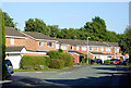
Housing in Templars Way, Penkridge, Staffordshire
This is in the Princefield area of Penkridge.
Image: © Roger D Kidd
Taken: 31 Aug 2014
0.05 miles
2
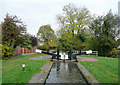
Filance Lock (No 37) in Penkridge, Staffordshire
The Staffordshire and Worcestershire canal, engineered by James Brindley, was fully opened through its 46 mile length in 1772. There are 43 locks (45 if you take the narrow staircase options to the river at Stourport on Severn). The northern end of the canal is at the junction with the Trent and Mersey Canal at Great Haywood, about eleven canal miles north-east of here.
This lock lowers the water level by 10ft 3in (just over three metres).
Image: © Roger D Kidd
Taken: 23 Oct 2009
0.08 miles
3
Filance Lock No 37
Along the Staffordshire and Worcestershire Canal in Penkridge.
Image: © Mat Fascione
Taken: 18 Aug 2016
0.09 miles
4
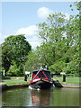
Narrowboat leaving Filance Lock at Penkridge, Staffordshire
Filance Lock is No 37 on the Staffordshire and Worcestershire Canal.
Image]
Image: © Roger D Kidd
Taken: 24 May 2011
0.09 miles
5
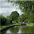
Filance Lock near Penkridge in Staffordshire
Filance Lock is No 37 on the Staffordshire and Worcestershire Canal near Penkridge, by Templars Way. It proviseds a fall (or rise) of 10ft 3in (about 3·1 metres).
Image: © Roger Kidd
Taken: 16 Aug 2012
0.10 miles
6
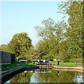
Filance Lock in Penkridge, Staffordshire
Filance Lock is No 37 on the Staffordshire and Worcestershire Canal. It lowers (or raises) the water level by 10ft 3in (3·12 metres).
Image: © Roger Kidd
Taken: 15 Oct 2011
0.10 miles
7
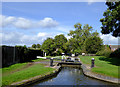
Filance Lock at Penkridge, Staffordshire
Lock No 37 on the Staffordshire and Worcestershire Canal, looking north.
Image: © Roger D Kidd
Taken: 29 Sep 2016
0.10 miles
8
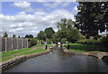
Filance Lock near Penkridge, Staffordshire
A narrowboat will soon enter the lock in order to continue its northward journey along the Staffordshire and Worcestershire Canal towards Great Haywood and the Trent Valley. This is Lock No 37, and will drop the water level by 10ft 3in (3·1 metres).
Image: © Roger D Kidd
Taken: 31 Aug 2013
0.10 miles
9
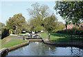
Filance Lock at Penkridge, Staffordshire
Filance Lock, No 37 on the Staffordshire and Worcestershire Canal, allows a fall of 10ft 3in (3·1 metres) as the navigation descends towards the River Trent at Great Haywood. Narrow locks like this on the inland waterways can accommodate boats with a beam of up to seven feet (2·1 metres) and a length of seventy feet (about 21·3 metres).
Housing on the right is in Templar's Way; to the left is Princefield Avenue.
The canal was opened in 1772, engineered by James Brindley. It cost a little over £100,000 at the time. The canal links the River Severn at Stourport to the Trent and Mersey Canal at Great Haywood Junction in Staffordshire. There are 43 locks (45 if you don't fancy the deep wide locks at Stourport) and the canal is 46 miles in length.
Image: © Roger D Kidd
Taken: 22 Oct 2011
0.10 miles
10

Filance Lock in Penkridge, Staffordshire
Filance Lock is No 37 on the Staffordshire and Worcestershire Canal. It lowers (or raises) the water level by 10ft 3in (3·12 metres). The tiller man did not need to be thrashing the water like that to make a controlled entry into the lock.
A minute or so later: Image]
Image: © Roger D Kidd
Taken: 31 Aug 2025
0.10 miles