
IMAGES TAKEN NEAR TO
Broc Close, STAFFORD, ST19 5EY
Introduction
This page details the photographs taken nearby to Broc Close, ST19 5EY by members of the Geograph project.
The Geograph project started in 2005 with the aim of publishing, organising and preserving representative images for every square kilometre of Great Britain, Ireland and the Isle of Man.

There are currently over 7.5m images from over14,400 individuals and you can help contribute to the project by visiting https://www.geograph.org.uk
Image Map
Images are licensed for reuse under creativecommons.org/licenses/by-sa/2.0
Notes
- Clicking on the map will re-center to the selected point.
- The higher the marker number, the further away the image location is from the centre of the postcode.
Image Listing (128 Images Found)
Images are licensed for reuse under creativecommons.org/licenses/by-sa/2.0
Image
Details
Distance
1
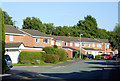
Housing in Templars Way, Penkridge, Staffordshire
This is in the Princefield area of Penkridge.
Image: © Roger D Kidd
Taken: 31 Aug 2014
0.13 miles
2
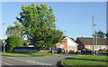
Greenways in Penkridge, Staffordshire
This is seen at the junction with Cannock Road.
Image: © Roger D Kidd
Taken: 31 Aug 2014
0.14 miles

4

Princefield First School, Penkridge
Image: © Jonathan Thacker
Taken: 3 Jun 2021
0.15 miles
5

M6 Motorway, Penkridge
Looking south from the bridge on Cannock Road.
Image: © JThomas
Taken: 18 May 2019
0.15 miles
6
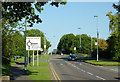
Cannock Road leaving Penkridge, Staffordshire
This is at the eastern edge of Penkridge.
Image: © Roger D Kidd
Taken: 31 Aug 2014
0.16 miles
8
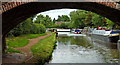
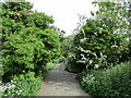
Staffordshire and Worcestershire Canal at Penkridge in Staffordshire
This is Staffordshire and Worcestershire Canal at Penkridge, looking north-east from beneath Princefield Bridge, No 85.
Image: © Roger D Kidd
Taken: 15 Aug 2013
0.17 miles
9
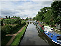
The Staffordshire and Worcestershire Canal at Penkridge
Image: © Jonathan Thacker
Taken: 3 Jun 2021
0.17 miles
10
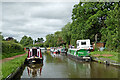
Canal in Penkridge, Staffordshire
Looking north-north-east from near Princefield Bridge, No 85. Private long-term moorings are on the right. Good visitor moorings are on the left here, and beyond Penkridge Lock (about three hundred metres ahead).
Yet another long distance path has been generated. This one is the Cross Britain Way, launched in 2014, 280 miles long, and passing along the towpath here. https://en.wikipedia.org/wiki/Cross_Britain_Way
Image: © Roger Kidd
Taken: 16 Jul 2016
0.17 miles