
IMAGES TAKEN NEAR TO
Marsh Lane, STAFFORD, ST19 5BW
Introduction
This page details the photographs taken nearby to Marsh Lane, ST19 5BW by members of the Geograph project.
The Geograph project started in 2005 with the aim of publishing, organising and preserving representative images for every square kilometre of Great Britain, Ireland and the Isle of Man.

There are currently over 7.5m images from over14,400 individuals and you can help contribute to the project by visiting https://www.geograph.org.uk
Image Map
Images are licensed for reuse under creativecommons.org/licenses/by-sa/2.0
Notes
- Clicking on the map will re-center to the selected point.
- The higher the marker number, the further away the image location is from the centre of the postcode.
Image Listing (96 Images Found)
Images are licensed for reuse under creativecommons.org/licenses/by-sa/2.0
Image
Details
Distance
1
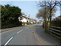
Looking north along Marsh Lane, Penkridge
Image: © Richard Law
Taken: 22 Mar 2012
0.10 miles
2
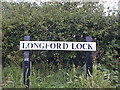
Longford Lock nameboard
The Staffordshire and Worcestershire Canal Society has put these attractive nameboards by each lock on the canal
Image: © Nick Atty
Taken: 23 Jul 2001
0.12 miles
3
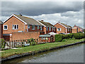
Canalside housing in Penkridge, Staffordshire
The housing by the Staffordshire and Worcestershire Canal is in Leacroft Road, in the area known as The Marsh.
Image: © Roger Kidd
Taken: 28 Jul 2015
0.15 miles
4
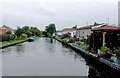
Canalside mobile homes at Penkridge, Staffordshire
The homes front on to Prescott Drive on Little Marsh Park.
Image: © Roger D Kidd
Taken: 12 Sep 2014
0.16 miles
5

Sheep grazing by the canal at Penkridge, Staffordshire
A large area of pasture is between the M6 motorway and the Staffordshire and Worcestershire Canal is south of Longford Lock by the northern edge of Penkridge.
Image: © Roger D Kidd
Taken: 12 Jun 2010
0.16 miles
6

Grazing by the canal near Penkridge, Staffordshire
A large area of pasture is between the M6 motorway and the Staffordshire and Worcestershire Canal south of Longford Lock.
Image: © Roger D Kidd
Taken: 12 Jun 2010
0.16 miles
7

Lamb grazing by the canal at Penkridge, Staffordshire
A large area of pasture is between the M6 motorway and the Staffordshire and Worcestershire Canal south of Longford Lock.
Image: © Roger D Kidd
Taken: 12 Jun 2010
0.16 miles
8

Staffordshire and Worcestershire Canal north of Penkridge, Staffordshire
Longford Lock is about a hundred metres ahead of the moored narrowboat.
Image: © Roger D Kidd
Taken: 21 Jun 2010
0.16 miles
9
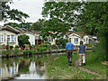
Housing by the canal near Penkridge in Staffordshire
This is the Staffordshire and Worcestershire Canal, looking south-west towards Penkridge Lock. The mobile homes are in Little Marsh Grove.
Image: © Roger Kidd
Taken: 2 Sep 2012
0.16 miles
10
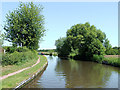
Staffordshire and Worcestershire Canal near Penkridge, Staffordshire
The Staffordshire and Worcestershire Canal was opened in 1772, and engineered by James Brindley. It cost a little over £100,000 at the time for its 46 mile course from Stourport to Great Haywood
Image: © Roger D Kidd
Taken: 21 Jun 2010
0.16 miles