
IMAGES TAKEN NEAR TO
Mayfield Avenue, STAFFORD, ST19 5AG
Introduction
This page details the photographs taken nearby to Mayfield Avenue, ST19 5AG by members of the Geograph project.
The Geograph project started in 2005 with the aim of publishing, organising and preserving representative images for every square kilometre of Great Britain, Ireland and the Isle of Man.

There are currently over 7.5m images from over14,400 individuals and you can help contribute to the project by visiting https://www.geograph.org.uk
Image Map
Images are licensed for reuse under creativecommons.org/licenses/by-sa/2.0
Notes
- Clicking on the map will re-center to the selected point.
- The higher the marker number, the further away the image location is from the centre of the postcode.
Image Listing (34 Images Found)
Images are licensed for reuse under creativecommons.org/licenses/by-sa/2.0
Image
Details
Distance
1
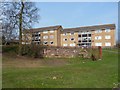
Flats above an old quarry in Vale Gardens
The small quarried face exposes the sandstone bedrock that underlies much of this area.
Image: © Richard Law
Taken: 22 Mar 2012
0.11 miles
2
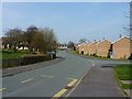
Along Vale Gardens, Penkridge
Street scene through one of Penkridge's housing estates.
Image: © Richard Law
Taken: 22 Mar 2012
0.12 miles
3
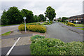
Wolverhampton Road, Penkridge
The residents have been given a quiet parallel side road off the main road.
Image: © Bill Boaden
Taken: 26 Jun 2015
0.15 miles
4
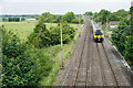
Train heading towards Wolverhampton
It has just left Penkridge station and is viewed from Bungham Lane.
Image: © Bill Boaden
Taken: 26 Jun 2015
0.15 miles
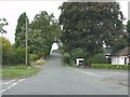
6
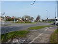
Roundabout on the A449
The roundabout sits at the junction of the A449 from Wolverhampton and the B5012 Wolgarston Way, which bypasses much of Penkridge to the SE side.
Image: © Richard Law
Taken: 22 Mar 2012
0.17 miles
7
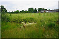
A field of mature oil seed rape
Some houses of Penkridge are behind.
Image: © Bill Boaden
Taken: 26 Jun 2015
0.17 miles

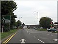
10

Brook running through a housing estate
The brook, apparently un-named on the maps, drains farmland to the south & east of Penkridge, and joins the R Penk just north of the town.
Image: © Richard Law
Taken: 22 Mar 2012
0.18 miles