IMAGES TAKEN NEAR TO
Pirehill Grange, Green Lane, STAFFORD, ST18 9RY
Introduction
This page details the photographs taken nearby to Pirehill Grange, Green Lane, ST18 9RY by members of the Geograph project.
The Geograph project started in 2005 with the aim of publishing, organising and preserving representative images for every square kilometre of Great Britain, Ireland and the Isle of Man.

There are currently over 7.5m images from over14,400 individuals and you can help contribute to the project by visiting https://www.geograph.org.uk
Image Map
Images are licensed for reuse under creativecommons.org/licenses/by-sa/2.0
Notes
- Clicking on the map will re-center to the selected point.
- The higher the marker number, the further away the image location is from the centre of the postcode.
Image Listing (11 Images Found)
Images are licensed for reuse under creativecommons.org/licenses/by-sa/2.0
Image
Details
Distance
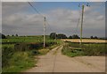
1
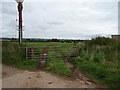
Field entrance off Green Lane
Near Pirehill Grange Farm.
Image: © JThomas
Taken: 7 Sep 2019
0.04 miles
2
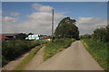
Green Lane
The lane, here a bridleway, passes the field of bales shown in Image Again, the square wood on the left shields the M6 Stafford southbound services from sight.
Image: © Derek Harper
Taken: 7 Sep 2012
0.06 miles
3
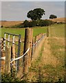
Bridleway near Pirehill Grange Farm
Towards Stone.
Image: © JThomas
Taken: 7 Sep 2019
0.06 miles
4
Pirehill Lane
Here a bridleway (Stone Rural 0.1135) following a track that links two public roads across high land east of Stafford Services on the M6.
Image: © Derek Harper
Taken: 7 Sep 2012
0.08 miles
5
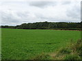
Field near Pirehill Grange Farm
The woodland in the distance shields the Stafford Services on the M6 Motorway.
Image: © JThomas
Taken: 7 Sep 2019
0.09 miles
6
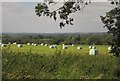
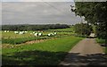
Bales by Green Lane
Beyond the field of silage bales and the cattle, the trees shield the M6 Stafford southbound services from sight.
Image: © Derek Harper
Taken: 7 Sep 2012
0.10 miles
7
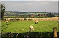
Sheep by Pirehill Grange
Across the fields is Staffordshire Fire and Rescue Headquarters at Pirehill House. A view from Green Lane, here a bridleway.
Image: © Derek Harper
Taken: 7 Sep 2012
0.10 miles
8
View from Green Lane
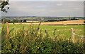
Countryside on the east side of the bridleway-cum-lane, looking towards the Trent valley and the southern outskirts of Stone.
Image: © Derek Harper
Taken: 7 Sep 2012
0.11 miles
9
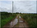
Green Lane at Bank View Farm
A track forks off the bridleway to farm buildings.
Image: © Derek Harper
Taken: 7 Sep 2012
0.13 miles