
IMAGES TAKEN NEAR TO
Haughton, STAFFORD, ST18 9DJ
Introduction
This page details the photographs taken nearby to ST18 9DJ by members of the Geograph project.
The Geograph project started in 2005 with the aim of publishing, organising and preserving representative images for every square kilometre of Great Britain, Ireland and the Isle of Man.

There are currently over 7.5m images from over14,400 individuals and you can help contribute to the project by visiting https://www.geograph.org.uk
Image Map
Images are licensed for reuse under creativecommons.org/licenses/by-sa/2.0
Notes
- Clicking on the map will re-center to the selected point.
- The higher the marker number, the further away the image location is from the centre of the postcode.
Image Listing (4 Images Found)
Images are licensed for reuse under creativecommons.org/licenses/by-sa/2.0
Image
Details
Distance
1
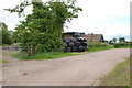
Storage Area On Layby
Winter fodder for cattle, the black bags will be full of Silage and the barn is full of Straw or Hay.
Image: © Mick Malpass
Taken: 19 Jun 2011
0.09 miles
2

Fields near Haughton.
Looking from the junction of Dale Lane and Back Lane towards the mass of protected cropping on the western flanks of Bury Ring. The trees on the top of the hill conceal an ancient hillfort.
Image: © Simon Huguet
Taken: 28 May 2010
0.23 miles
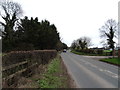
4
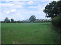
Grassy field
An empty grassy field. The trees on the high ground on the horizon mark the earthworks of an iron age fort, called Bury Ring
Image: © Andrew Spenceley
Taken: 27 Aug 2006
0.25 miles