
IMAGES TAKEN NEAR TO
Mount Edge, STAFFORD, ST18 0TG
Introduction
This page details the photographs taken nearby to Mount Edge, ST18 0TG by members of the Geograph project.
The Geograph project started in 2005 with the aim of publishing, organising and preserving representative images for every square kilometre of Great Britain, Ireland and the Isle of Man.

There are currently over 7.5m images from over14,400 individuals and you can help contribute to the project by visiting https://www.geograph.org.uk
Image Map
Images are licensed for reuse under creativecommons.org/licenses/by-sa/2.0
Notes
- Clicking on the map will re-center to the selected point.
- The higher the marker number, the further away the image location is from the centre of the postcode.
Image Listing (8 Images Found)
Images are licensed for reuse under creativecommons.org/licenses/by-sa/2.0
Image
Details
Distance
2
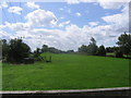
Disappearing railway
The railway line from Stafford to Uttoxeter used to cross this field on an embankment and then bridge the road the photographer is standing on. Now all that remains is the grassy mound in the background.
Image: © Andrew Spenceley
Taken: 27 Aug 2006
0.10 miles
3
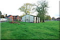
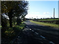
WW2 Building in Hopton from Sandon Lane
Image: © Mick Malpass
Taken: 12 Nov 2011
0.11 miles
5
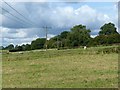
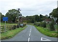
Gone without trace
Looking along the alignment of the former Stafford and Uttoxeter Railway. This closed in 1951 and has been returned to agricultural use without any trace here.
Image: © Alan Murray-Rust
Taken: 23 Aug 2017
0.13 miles
8
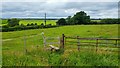
Public footpath near Hopton, Staffordshire
Located near the top of Church Hill. The stile, as seemed to be the case with almost all stiles in Staffordshire I encountered on this day, was very perilous and acted similarly to a see-saw. Unlike those in Leicestershire, the entrances to footpaths are often not very clearly marked (except for the more major paths, which feature attractive wood signposts) and without the clearly visible markers on the opposite end of fields. In this case, the next stile was located vaguely within the large trees in the distance, and in even poorer condition than this stile! The scenery is certainly lovely, however.
Image: © Oliver Mills
Taken: 14 Jul 2020
0.25 miles