
IMAGES TAKEN NEAR TO
Airfield Industrial Estate, STAFFORD, ST18 0PF
Introduction
This page details the photographs taken nearby to Airfield Industrial Estate, ST18 0PF by members of the Geograph project.
The Geograph project started in 2005 with the aim of publishing, organising and preserving representative images for every square kilometre of Great Britain, Ireland and the Isle of Man.

There are currently over 7.5m images from over14,400 individuals and you can help contribute to the project by visiting https://www.geograph.org.uk
Image Map
Images are licensed for reuse under creativecommons.org/licenses/by-sa/2.0
Notes
- Clicking on the map will re-center to the selected point.
- The higher the marker number, the further away the image location is from the centre of the postcode.
Image Listing (10 Images Found)
Images are licensed for reuse under creativecommons.org/licenses/by-sa/2.0
Image
Details
Distance
1

Stile for Footpath to Station Road, Hixon Industrial Estate, Hixon, Staffordshire
Image: © Mick Malpass
Taken: 9 Jul 2011
0.09 miles
2

Units on Hixon Industrial Estate, Hixon, Staffordshire
Image: © Mick Malpass
Taken: 9 Jul 2011
0.10 miles
3
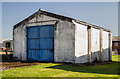
WWII Staffordshire: RAF Hixon - Searchlight Shed (3)
A history of RAF Hixon has it on record that this is a building that housed a searchlight. Presumably this was a substitute for a tractor towed floodlight trolley for airfields such as Hixon that had no permanent runway lighting system in place. The searchlight apparently ran on rails, as there are a set of rails outside leading into the shed.
Image
Image: © Mike Searle
Taken: 14 Sep 2020
0.15 miles
4
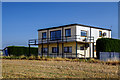
WWII Staffordshire: RAF Hixon - Control Tower (1)
A Watch Office for all Commands (AM No. 12779/41) with medium front windows (AM No.343/43), now restored and in use as offices.
History:
RAF Hixon airfield opened in May 1942 as a satellite to RAF Lichfield for RAF Bomber Command's 30 OTU. They formed here in June 1942 specifically for night bomber training, operating with Vickers Wellington twin engined bombers. After the war the site was used by the RAF for storage, and following its closure in 1957, it then became an industrial estate.
Image
Image: © Mike Searle
Taken: 14 Sep 2020
0.16 miles
5
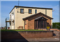
WWII Staffordshire: RAF Hixon - Control Tower (2)
-
Image
Image: © Mike Searle
Taken: 14 Sep 2020
0.16 miles
6

Footpath leaving New Road
The path goes through the Airfield Industrial Estate but cannot cross the airfield itself.
Image: © Bill Boaden
Taken: 28 Dec 2012
0.19 miles
7

New Road leaving Hixon
The village sign for Hixon is already behind me, and the houses ahead could be described as Hixon Heath.
Image: © Bill Boaden
Taken: 28 Dec 2012
0.20 miles
8

Main entrance to Hixon Industrial Estate, Hixon, Staffordshire.
The main entrance is right in the south-eastern corner of the grid square. The industrial estate is located on the former wartime RAF bomber airfield, that can be found just to the north-west of Hixon village. This entrance has a barrier pole and is manned by a security guard; however, this is still not quite the level of security that there would have been here during the War! This was possibly the main entrance to the RAF station, judging by the avenue of trees either side of the road that bends round to the left and the large white pre-fabricated concrete building, also on the left (the corner of which is just visible); this appears to be the former guardroom.
Image: © Alan Slater
Taken: 23 Jul 2006
0.21 miles
9

WWII Staffordshire: RAF Hixon - Station HQ? (4)
One history records this building as a former guardroom, but it resembles no RAF guardroom that I've ever seen, but it does look remarkably like a Station HQ. I believe the Guardroom would have been on the opposite side of the road, where its modern equivalent now stands.
Image
Image: © Mike Searle
Taken: 14 Sep 2020
0.22 miles
10

Entrance to Airfield Industrial Estate
The north-western side of Hixon offers opportunities for local employment. The airfield was a WW2 bomber base, but is no longer in use.
Image: © Bill Boaden
Taken: 28 Dec 2012
0.23 miles