
IMAGES TAKEN NEAR TO
Church Lane, STAFFORD, ST18 0HL
Introduction
This page details the photographs taken nearby to Church Lane, ST18 0HL by members of the Geograph project.
The Geograph project started in 2005 with the aim of publishing, organising and preserving representative images for every square kilometre of Great Britain, Ireland and the Isle of Man.

There are currently over 7.5m images from over14,400 individuals and you can help contribute to the project by visiting https://www.geograph.org.uk
Image Map
Images are licensed for reuse under creativecommons.org/licenses/by-sa/2.0
Notes
- Clicking on the map will re-center to the selected point.
- The higher the marker number, the further away the image location is from the centre of the postcode.
Image Listing (20 Images Found)
Images are licensed for reuse under creativecommons.org/licenses/by-sa/2.0
Image
Details
Distance
1
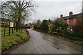
Church Lane, Gayton
The village was recorded in the Domesday Book though clearly all the buildings are much more recent.
Image: © Bill Boaden
Taken: 28 Dec 2012
0.02 miles
3
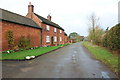
Farmhouse and buildings, Church Lane, Gayton
Image: © Mick Malpass
Taken: 13 Nov 2011
0.04 miles
4
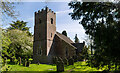
St Peter's Church, Gayton
St. Peter is the parish church of Gayton. The oldest part of the church is the archway between the nave and the chancel, dating from the 12th Century, with the body of the chancel added in the 13th century and the tower added 1732. The earliest parish register dates from 1584.
https://en.wikipedia.org/wiki/Gayton,_Staffordshire#St._Peter's_Church
Image: © Brian Deegan
Taken: 30 Apr 2022
0.04 miles
5
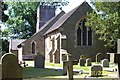
St Peters Church Gayton
The village parish church taken on a sunny day in 2012
Image: © Charles Deavall
Taken: 30 May 2015
0.05 miles
6
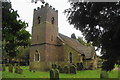
St Peter's Church. Gayton
Village church with the earliest parts dating from the 12th Century. The tower was built in 1732.
Image: © Bill Boaden
Taken: 28 Dec 2012
0.05 miles
7
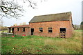
Red brick farm buildings on Church Lane, Gayton
Image: © Mick Malpass
Taken: 13 Nov 2011
0.07 miles
8
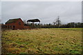
Farm buildings at Gayton
This is an area for grazing horses between two separate parts of the village.
Image: © Bill Boaden
Taken: 28 Dec 2012
0.08 miles
9
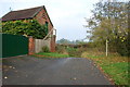
End of Church Lane, Gayton
This lovely red brick building with access stairs, marks the end of Church Lane; from here the lane goes through a ford, turns left and becomes a farm track.
Image: © Mick Malpass
Taken: 13 Nov 2011
0.10 miles
10
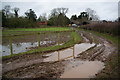
Muddy farm track by Moat Farm
I don't think the footpath originally followed this track but the proper stile was blocked off by tape.
Image: © Bill Boaden
Taken: 28 Dec 2012
0.11 miles