
IMAGES TAKEN NEAR TO
Sandon, STAFFORD, ST18 0BY
Introduction
This page details the photographs taken nearby to ST18 0BY by members of the Geograph project.
The Geograph project started in 2005 with the aim of publishing, organising and preserving representative images for every square kilometre of Great Britain, Ireland and the Isle of Man.

There are currently over 7.5m images from over14,400 individuals and you can help contribute to the project by visiting https://www.geograph.org.uk
Image Map
Images are licensed for reuse under creativecommons.org/licenses/by-sa/2.0
Notes
- Clicking on the map will re-center to the selected point.
- The higher the marker number, the further away the image location is from the centre of the postcode.
Image Listing (21 Images Found)
Images are licensed for reuse under creativecommons.org/licenses/by-sa/2.0
Image
Details
Distance
1

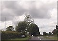
Sandon Hall
Ancestral home of the Earls of Harrowby.
Image: © John H Darch
Taken: 4 Jul 2019
0.04 miles
3

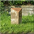
Old Milepost by the A51, near Sandon Hall, Sandon & Burston parish
Cast iron post by the A51, in parish of Sandon & Burston (Stafford District), between Sandon and Weston, on grass, on Northeast side of road. Cochrane iron casting, erected by the County Council in the 20th century.
Inscription reads:-
: WESTON 1¾ / RUGELEY 9½ / LICHFIELD 17 / LONDON 136 : : SANDON / PARISH : : SANDON ¾ / STONE 5 / NEWCASTLE 13½ :
Maker:-
: Cochrane & Co, Dudley. :
Staffordshire HER.
HER Number: 51337 https://www.heritagegateway.org.uk/Gateway/Results_Single.aspx?uid=MST12560&resourceID=1010
Milestone Society National ID: ST_LFSN17
Image: © J Higgins
Taken: 1 Jan 2001
0.16 miles
4
Milestone on the A51 at Sandon Park
Standard Staffordshire triangular cast iron style - Heritage Gateway dates it 1909-10, on the former turnpike road between Chester and Lichfield, now the A51. See http://www.geograph.org.uk/photo/5524207 for location.
Image: © Alan Murray-Rust
Taken: 23 Aug 2017
0.17 miles
5

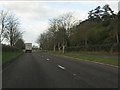
The A51 at Sandon Park
Note the milestone http://www.geograph.org.uk/photo/5524202 in the verge at the left hand side.
Image: © Alan Murray-Rust
Taken: 23 Aug 2017
0.17 miles

8
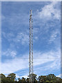
Communications mast near Salt in Staffordshire
Someone told me that this is connected to modern GSM-R railway signalling networks on the West Coast Main Line (Trent Valley). https://en.wikipedia.org/wiki/GSM-R
Seen by the Trent and Mersey Canal.
Image]
Image: © Roger Kidd
Taken: 10 Sep 2019
0.20 miles
9

Communications mast (detail) near Salt in Staffordshire
Someone told me that this is connected to modern GSM-R railway signalling networks on the West Coast Main Line (Trent Valley).
Seen by the Trent and Mersey Canal.
Image]
Image: © Roger Kidd
Taken: 10 Sep 2019
0.20 miles
10
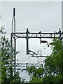
Railway gantries north-west of Weston in Staffordshire
A telephoto image taken from the canal, looking north-west. The railway is the line between Lichfield and Stoke-on-Trent.
Image: © Roger Kidd
Taken: 25 May 2011
0.20 miles