IMAGES TAKEN NEAR TO
Parkfields, STAFFORD, ST17 9RD
Introduction
This page details the photographs taken nearby to Parkfields, ST17 9RD by members of the Geograph project.
The Geograph project started in 2005 with the aim of publishing, organising and preserving representative images for every square kilometre of Great Britain, Ireland and the Isle of Man.

There are currently over 7.5m images from over14,400 individuals and you can help contribute to the project by visiting https://www.geograph.org.uk
Image Map (Loading...)


Getting Data...Please wait
Leaflet Map data © OpenStreetMap
Images are licensed for reuse under creativecommons.org/licenses/by-sa/2.0
Notes
- Clicking on the map will re-center to the selected point.
- The higher the marker number, the further away the image location is from the centre of the postcode.
Image Listing (11 Images Found)
Images are licensed for reuse under creativecommons.org/licenses/by-sa/2.0
Image
Details
Distance
1
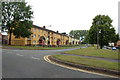
Colourful flats, Averill Road, Stafford
Image: © Mick Malpass
Taken: 17 Jul 2011
0.10 miles
3
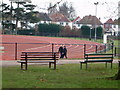
Rowley Park Stadium
Rowley stadium, benefited greatly from lottery money
Image: © David Bagshaw
Taken: 2 Jan 2006
0.12 miles
4
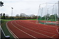
Rowley Park Stadium
A well-equipped venue for athletics in a council-owned park.
Image: © Bill Boaden
Taken: 2 Apr 2011
0.12 miles
5
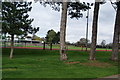
Rowley Park
This was part of the grounds of Rowley Hall but was given to the local council as a park. You can still see Rowley Hall in the trees in the background, but it is now a private hospital.
Image: © Bill Boaden
Taken: 2 Apr 2011
0.14 miles
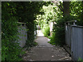
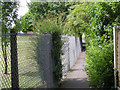
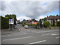
7
Junction of Lea Crescent and West Way, Rising Brook
Lea Crescent (left) joins West Way (right) close to the latter's south eastern end, where it joins the A449.
Image: © Richard Vince
Taken: 22 Jun 2015
0.23 miles
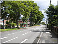
8
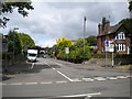
East end of Park Avenue, Rising Brook
Seen from the A449 Rowley Bank.
Image: © Richard Vince
Taken: 22 Jun 2015
0.23 miles
9
East end of Highfield Grove, Rising Brook
Seen from the A449 Rowley Bank.
Image: © Richard Vince
Taken: 22 Jun 2015
0.24 miles
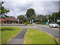
10
South end of Rowley Bank, Rising Brook
Looking towards Stafford town centre from just north of the junction with West Way.
Image: © Richard Vince
Taken: 22 Jun 2015
0.25 miles