
IMAGES TAKEN NEAR TO
Crescent Road, STAFFORD, ST17 9AN
Introduction
This page details the photographs taken nearby to Crescent Road, ST17 9AN by members of the Geograph project.
The Geograph project started in 2005 with the aim of publishing, organising and preserving representative images for every square kilometre of Great Britain, Ireland and the Isle of Man.

There are currently over 7.5m images from over14,400 individuals and you can help contribute to the project by visiting https://www.geograph.org.uk
Image Map
Images are licensed for reuse under creativecommons.org/licenses/by-sa/2.0
Notes
- Clicking on the map will re-center to the selected point.
- The higher the marker number, the further away the image location is from the centre of the postcode.
Image Listing (24 Images Found)
Images are licensed for reuse under creativecommons.org/licenses/by-sa/2.0
Image
Details
Distance
1
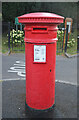
An anonymous pillar letter box in Rowley Park, Stafford
Anonymous pillar letter boxes are boxes without a Royal cypher. They were manufactured by Andrew Handyside & Co., Derby, between 1879 and 1887 and omitted the words POST OFFICE and the VR royal cypher in error hence the description anonymous. Installed anonymous boxes were not recalled. This box was manufactured during the period that the Rowley Park private estate was being developed.
Behind the box is an entrance to Rowley Park Pleasure Gardens which are accessible only to Rowley Park residents.
Image: © Rod Grealish
Taken: 11 Aug 2024
0.05 miles
2
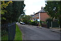
Houses on Lawn Road, Rowley Park Estate, Stafford
There is a mixture of modern and older houses on Lawn Road. The metal fencing on the left marks the boundary of Rowley Park Gardens, a recreational area open only to residents of Rowley Park.
Image: © Rod Grealish
Taken: 8 Sep 2020
0.09 miles
4
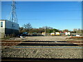
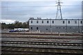
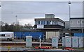
Sidings at Stafford Trent Valley Junction
Image: © Roy Hughes
Taken: 19 Mar 2022
0.17 miles
5
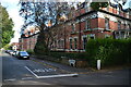
Houses on Lawn Road, Rowley Park Estate, Stafford
Grade II listed houses on Lawn Road in Rowley Park Estate, a private estate built in 1868. They were designed by Robert Griffiths, the Staffordshire County Surveyor, who was known as an architect of lunatic asylums (a term used at the time but now replaced by mental health units, behavioural health units or similar terms).
Image: © Rod Grealish
Taken: 8 Sep 2020
0.17 miles
6

Wall Box, Junction of Wolverhampton Road and Rowley Grove, Stafford
This Victorian wall box was manufactured by W.T. Allan & Co of Lambeth Hill, London. The company operated from 1881 to 1955. The white information plate seems to be too big for the slot.
Image: © Rod Grealish
Taken: 22 Aug 2025
0.18 miles
9
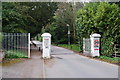
Entrance to the Rowley Park Estate
It is a private road from here on. The sign states that anyone can be turned back unless on genuine business.
Image: © Bill Boaden
Taken: 2 Apr 2011
0.21 miles
10
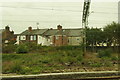
Houses backing on to the railway, Stafford
Image: © Mike Pennington
Taken: 28 Aug 2018
0.22 miles