
IMAGES TAKEN NEAR TO
Ardingley Avenue, STAFFORD, ST17 4TN
Introduction
This page details the photographs taken nearby to Ardingley Avenue, ST17 4TN by members of the Geograph project.
The Geograph project started in 2005 with the aim of publishing, organising and preserving representative images for every square kilometre of Great Britain, Ireland and the Isle of Man.

There are currently over 7.5m images from over14,400 individuals and you can help contribute to the project by visiting https://www.geograph.org.uk
Image Map
Images are licensed for reuse under creativecommons.org/licenses/by-sa/2.0
Notes
- Clicking on the map will re-center to the selected point.
- The higher the marker number, the further away the image location is from the centre of the postcode.
Image Listing (153 Images Found)
Images are licensed for reuse under creativecommons.org/licenses/by-sa/2.0
Image
Details
Distance
1
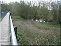
River Penk from footbridge, Baswich, Staffordshire.
Image: © Tim Marshall
Taken: 31 Mar 2009
0.11 miles
2
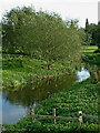
River Penk near Queensville. Stafford
Looking south (upstream) from the footbridge/walkway between Queensville and Baswich.
Image: © Roger Kidd
Taken: 1 Sep 2012
0.11 miles
3
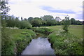
The River Penk, Upstream
This is the River Penk taken from a walkway over the river.
Image: © Stephen Pearce
Taken: 22 May 2007
0.12 miles
4
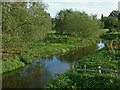
River Penk near Queensville. Stafford
Looking south (upstream) from the footbridge/walkway between Queensville and Baswich.
Image: © Roger Kidd
Taken: 1 Sep 2012
0.12 miles
5
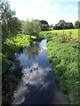
River Penk near Radford Bank
Looking placid in this view, the River Penk meanders through water meadows near to Radford Bank. Photo taken from the causeway carrying the Brocton - Stafford cycle route/footpath.
Image: © Tim Marshall
Taken: 13 Sep 2012
0.12 miles
8
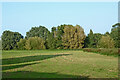
Grass and woodland near Radford Bank in Stafford
Looking north-east, this well maintained grassland is on the flood plain of the River Penk north of Radford Bridge. It is a popular open space open to the public and includes a children's playground (off to the left). The river flows northwards from right to left at base of the trees. Behind the trees, the Deepmore Drain also flows northwards, joining the River Penk near Baswich. On the right, hidden in the rough, is the Rickerscote Drain, flowing towards the Penk.
Image: © Roger Kidd
Taken: 11 Sep 2014
0.14 miles
9
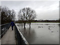
Flooding at Baswich
The causeway leading from the towpath of the Staffs & Worcs canal at Baswich. The reason for the causeway is clear as the river Sow has flooded fields again, a regular occurrence here. Happily the floodwater usually subsides quickly and there are no houses likely to be affected.
Image: © Tim Marshall
Taken: 29 Jan 2013
0.14 miles
10
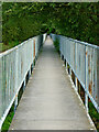
Raised walkway across the River Penk near Stafford
Looking south-east towards Baswich and Weeping Cross. The raised walkway/bridge is just under two hundred metres long, and carries a footpath and cycleway across the River Penk, its flood plain and the Deepmore Drain.
Sustrans cycle Route 5 comes this way.
Image: © Roger Kidd
Taken: 1 Sep 2012
0.14 miles