IMAGES TAKEN NEAR TO
Rookswood Copse, STAFFORD, ST17 4NF
Introduction
This page details the photographs taken nearby to Rookswood Copse, ST17 4NF by members of the Geograph project.
The Geograph project started in 2005 with the aim of publishing, organising and preserving representative images for every square kilometre of Great Britain, Ireland and the Isle of Man.

There are currently over 7.5m images from over14,400 individuals and you can help contribute to the project by visiting https://www.geograph.org.uk
Image Map
Images are licensed for reuse under creativecommons.org/licenses/by-sa/2.0
Notes
- Clicking on the map will re-center to the selected point.
- The higher the marker number, the further away the image location is from the centre of the postcode.
Image Listing (11 Images Found)
Images are licensed for reuse under creativecommons.org/licenses/by-sa/2.0
Image
Details
Distance
1
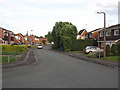
Sweetbriar Way
Sweetbriar Way, a revisit as part of the Domesday Project
Image: © David Bagshaw
Taken: 23 May 2011
0.14 miles
2
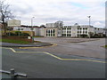
Marshlands Primary School (Special)
In middle of Wildwood Estate, difficult to find?
Update: in 2014 Marshlands School, which provides for children with special needs, moved to new premises in Second Avenue in Image and the Wildwood premises seen here are now the home of Barnfields School (information from Alison Brown).
Image: © Jack Barber
Taken: 24 Feb 2007
0.15 miles
3
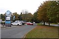
Wildwood
A suburb of Stafford. Memories of training runs with Walton Chasers in the 1980s.
Image: © Richard Webb
Taken: 17 Oct 2015
0.19 miles
4
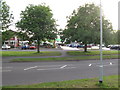
Wildwood Supermarket
A retake as part of domesday revisited
Image: © David Bagshaw
Taken: 23 May 2011
0.20 miles
5
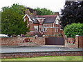
Crossfields by Cannock Road near Stafford
This substantial property, photographed in 2015, dates from the early 1880s. For forty years it was used as offices for the nearby (already demolished in 2013) former police headquarters on the opposite side of the road.
In 2021 an application was made to demolish it and build a 76 bed care home. https://planning.org.uk/app/151/QZ0SJAPSLLK00/ https://www.expressandstar.com/news/local-hubs/staffordshire/stafford/2022/01/25/former-police-authority-offices-could-make-way-for-76-bed-care-home/
Image: © Roger Kidd
Taken: 4 Aug 2015
0.21 miles
6
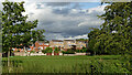
Wildwood Park Sports Fields and housing, Stafford
Seen from the Staffordshire and Worcestershire Canal. The housing is in Hartsbourne Way, off Wildwood Drive.
Image: © Roger Kidd
Taken: 28 Jul 2015
0.22 miles
7
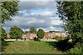
Wildwood Park Sports Fields and housing, Stafford
Seen from the Staffordshire and Worcestershire Canal. The housing is in Hartsbourne Way, off Wildwood Drive.
Image: © Roger Kidd
Taken: 28 Jul 2015
0.23 miles
8
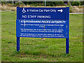
Police Headquarters sign by Cannock Road in Stafford
The buildings were demolished in 2013 but although the site was open as temporary parkland for a few years, this sign and a tall communications mast remained. As I write in 2023, the area is covered with new housing in imaginatively named streets like Sergeant Way and Constable Close. They missed out on having a row of Copper Cottages, but Stafford residents can't have everything!
Image: © Roger Kidd
Taken: 4 Aug 2015
0.24 miles
9
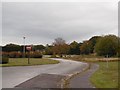
Staffordshire Constabulary HQ site
The police have flitted leaving a parkland site on a strategic junction unoccupied.
Image: © Richard Webb
Taken: 17 Oct 2015
0.24 miles