IMAGES TAKEN NEAR TO
Salt Avenue, STAFFORD, ST17 4DW
Introduction
This page details the photographs taken nearby to Salt Avenue, ST17 4DW by members of the Geograph project.
The Geograph project started in 2005 with the aim of publishing, organising and preserving representative images for every square kilometre of Great Britain, Ireland and the Isle of Man.

There are currently over 7.5m images from over14,400 individuals and you can help contribute to the project by visiting https://www.geograph.org.uk
Image Map
Images are licensed for reuse under creativecommons.org/licenses/by-sa/2.0
Notes
- Clicking on the map will re-center to the selected point.
- The higher the marker number, the further away the image location is from the centre of the postcode.
Image Listing (43 Images Found)
Images are licensed for reuse under creativecommons.org/licenses/by-sa/2.0
Image
Details
Distance
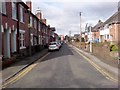
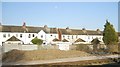
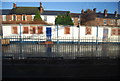
4

The Queensville curve, West Coast Main Line, Stafford looking north-west
The Queensville curve was built in 1846 as part of the direct line to Rugby at the point where it leaves the Stafford-Birmingham-Rugby route built in 1837. The line turns by 90 degrees here. Pendolino trains demonstrate their characteristic tilting on the curve.
Image: © Rod Grealish
Taken: 22 Aug 2025
0.14 miles
5
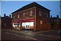
1st Stop convenience store and post office on Wolverhampton Road, Stafford
The image was taken at dusk. The building has had many food and drink related uses. It was first occupied by The Stafford Co-operative Society Ltd as their branch no 5. This is shown on the painted band over the first floor windows (barely visible in the image).
Image: © Rod Grealish
Taken: 9 Aug 2024
0.14 miles
6
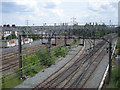
Euston line on the left & Birmingham on the right
Image: © Row17
Taken: 16 Jun 2008
0.14 miles
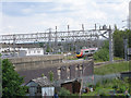
8
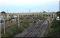
Junction of WCML Trent Valley line and WCML W. Midlands line
The West Coast Main Line was opened in sections. The original route, to the right, was opened in 1837 and went through the West Midlands (Wolverhampton, Birmingham and Coventry). The more direct line avoiding the West Midlands conurbation was opened in 1847 rejoining the original line at Rugby. The newer line curves sharply here to the left on what is known as the Queensville curve. The image was taken from Wolverhampton Road railway bridge, Stafford.
Image: © Rod Grealish
Taken: 11 Aug 2024
0.14 miles