
IMAGES TAKEN NEAR TO
The Green, STAFFORD, ST17 4BH
Introduction
This page details the photographs taken nearby to The Green, ST17 4BH by members of the Geograph project.
The Geograph project started in 2005 with the aim of publishing, organising and preserving representative images for every square kilometre of Great Britain, Ireland and the Isle of Man.

There are currently over 7.5m images from over14,400 individuals and you can help contribute to the project by visiting https://www.geograph.org.uk
Image Map
Images are licensed for reuse under creativecommons.org/licenses/by-sa/2.0
Notes
- Clicking on the map will re-center to the selected point.
- The higher the marker number, the further away the image location is from the centre of the postcode.
Image Listing (372 Images Found)
Images are licensed for reuse under creativecommons.org/licenses/by-sa/2.0
Image
Details
Distance
1

No 1 and No 6 The Green, Stafford
Two grade II listed buildings side-by-side. No 1 in on the right and No 6 on the left,
No 1 was built about 1840 and is grade II listed. The building is described on the Historic England as "House now flats". Following planning permission granted in 1993 the flats were converted to offices. The current occupants are E L M Group Ltd.
No 6 was built in the mid to late 18th century and is grade II listed "for group value". The overlight to the door shows that the building is occupied by the local charity A Child of Mine.
Image: © Rod Grealish
Taken: 13 Aug 2025
0.00 miles
2
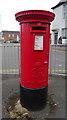
George VI postbox on Bailey Street, Stafford
Postbox No. ST16 122.
See Image] for context.
Image: © JThomas
Taken: 18 May 2019
0.01 miles
3

Stafford Baptist Church with Latice Spire
Image: © Mick Malpass
Taken: 27 Jun 2011
0.01 miles
4

Right return to No 1 The Green, Stafford
No 1 was built about 1840 and, with the attached screen wall, is grade II listed. The image shows the 1870 gabled porch and the attached parapetted screen wall. A modern touch - an EV charger linked to the car.
Image: © Rod Grealish
Taken: 13 Aug 2025
0.01 miles
5

Stafford Baptist Church
Showing position of Postbox No. ST16 122.
See Image] for postbox.
Image: © JThomas
Taken: 18 May 2019
0.01 miles
6

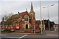
Stafford Baptist Church, Wolverhampton Road
The church is by the roundabout at the junction of Wolverhampton Road and Lichfield Road. Its official address is Bailey Street, as it has a frontage to that street as well as to Wolverhampton Road.
Image: © P L Chadwick
Taken: 1 May 2010
0.02 miles
8
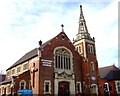
Stafford Baptist Church, Forebridge
A mid C19th church with a most unusual skeleton spire.
Image: © Simon Huguet
Taken: 12 Apr 2008
0.02 miles
10
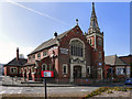
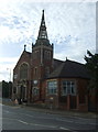
Stafford Baptist Church
The Baptist church on Lichfield Road.
Image: © David Dixon
Taken: 12 Apr 2011
0.03 miles