
IMAGES TAKEN NEAR TO
Heather Close, STAFFORD, ST17 0TG
Introduction
This page details the photographs taken nearby to Heather Close, ST17 0TG by members of the Geograph project.
The Geograph project started in 2005 with the aim of publishing, organising and preserving representative images for every square kilometre of Great Britain, Ireland and the Isle of Man.

There are currently over 7.5m images from over14,400 individuals and you can help contribute to the project by visiting https://www.geograph.org.uk
Image Map
Images are licensed for reuse under creativecommons.org/licenses/by-sa/2.0
Notes
- Clicking on the map will re-center to the selected point.
- The higher the marker number, the further away the image location is from the centre of the postcode.
Image Listing (25 Images Found)
Images are licensed for reuse under creativecommons.org/licenses/by-sa/2.0
Image
Details
Distance
1
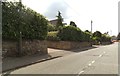
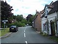
Pool Lane
The view in Brocton Staffordshire looking towards the village green.
Image: © Gordon Griffiths
Taken: 9 Jul 2014
0.12 miles
3
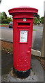
George VI postbox on Pool Lane, Brocton
Outside the Post Office.
Postbox No. ST17 196.
Image: © JThomas
Taken: 18 May 2019
0.17 miles
5
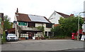
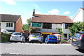
Brocton Post Office
On Pool Lane, Brocton.
Showing position of Postbox No. ST17 196.
Image: © JThomas
Taken: 18 May 2019
0.17 miles

10
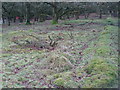
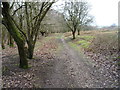
Brocton Camp (J-Lines) Barrack Hut Bases
Bases for a double line of standard 60'x 20'(18.3 x 6.1m) barrack huts are built into the slope of Tar Hill in 1914/5. The huts were sold off after the Great War and area planted with trees.
For typical hut see Image
Image: © John M
Taken: 10 Feb 2018
0.19 miles