
IMAGES TAKEN NEAR TO
Weeping Cross, STAFFORD, ST17 0DG
Introduction
This page details the photographs taken nearby to Weeping Cross, ST17 0DG by members of the Geograph project.
The Geograph project started in 2005 with the aim of publishing, organising and preserving representative images for every square kilometre of Great Britain, Ireland and the Isle of Man.

There are currently over 7.5m images from over14,400 individuals and you can help contribute to the project by visiting https://www.geograph.org.uk
Image Map
Images are licensed for reuse under creativecommons.org/licenses/by-sa/2.0
Notes
- Clicking on the map will re-center to the selected point.
- The higher the marker number, the further away the image location is from the centre of the postcode.
Image Listing (43 Images Found)
Images are licensed for reuse under creativecommons.org/licenses/by-sa/2.0
Image
Details
Distance
1
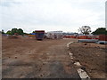
Construction site, Weeping Cross
New houses being built.
Image: © JThomas
Taken: 18 May 2019
0.06 miles
2
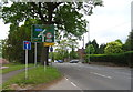
Weeping Cross (A513) towards Stafford
Looking north west.
Image: © JThomas
Taken: 18 May 2019
0.07 miles
3
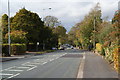
The A513 Weeping Cross
A leafy route into Stafford.
Image: © Bill Boaden
Taken: 21 Oct 2011
0.08 miles
4
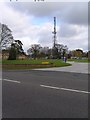
Staffordshire Police Headquarters Radio Mast
Good landmark, can be seen from miles around
Image: © Jack Barber
Taken: 1 Mar 2007
0.10 miles
5
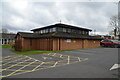
St Anne's Catholic Church, Weeping Cross, Stafford
The parish of St Anne's was created in 1964. A dual-purpose church and hall opened in 1966. The present church was built in 1986-7 and the original building became the church hall.
Image: © Rod Grealish
Taken: 4 Mar 2024
0.10 miles
6
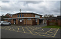
St Anne's Church Hall, Weeping Cross, Stafford
The parish of St Anne's was created in 1964. The church hall, shown here, was opened in 1966 as a dual-purpose church and hall. The present church was built in 1986-7 and the original building became the church hall.
Image: © Rod Grealish
Taken: 4 Mar 2024
0.11 miles
7
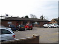
Weeping Cross Health Centre, Bodmin Avenue, Stafford
Image: © Tim Marshall
Taken: 16 Mar 2009
0.12 miles
8

Park land and communications mast near Weeping Cross
The grassy and partly wooded open park land and communications mast were part of the former police headquarters site by Cannock Road. It is now fully built over with housing in streets called Sergeant Way and Constable Close!
Image: © Roger Kidd
Taken: 4 Aug 2015
0.13 miles
9
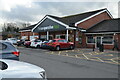
Co-operative food supermarket Lynton Avenue, Weeping Cross, Stafford
A food supermarket operated by Central England Co-operative Limited. The site was originally contained a public house known as The Crossbow opened in the 1960's and later renamed The Lynton Tavern. It was demolished in 2015 to make way for the supermarket.
Image: © Rod Grealish
Taken: 4 Mar 2024
0.13 miles
10
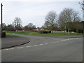
Junction of Bodmin Avenue and Dawlish Avenue, Weeping Cross, Stafford
Image: © Tim Marshall
Taken: 16 Mar 2009
0.13 miles