IMAGES TAKEN NEAR TO
Bagot Grove, STOKE-ON-TRENT, ST1 6JD
Introduction
This page details the photographs taken nearby to Bagot Grove, ST1 6JD by members of the Geograph project.
The Geograph project started in 2005 with the aim of publishing, organising and preserving representative images for every square kilometre of Great Britain, Ireland and the Isle of Man.

There are currently over 7.5m images from over14,400 individuals and you can help contribute to the project by visiting https://www.geograph.org.uk
Image Map
Images are licensed for reuse under creativecommons.org/licenses/by-sa/2.0
Notes
- Clicking on the map will re-center to the selected point.
- The higher the marker number, the further away the image location is from the centre of the postcode.
Image Listing (18 Images Found)
Images are licensed for reuse under creativecommons.org/licenses/by-sa/2.0
Image
Details
Distance
1
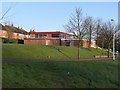
Sneyd Green Community Centre, Ralph Drive
Sneyd Green Community Centre Building in Ralph Drive, Sneyd Green, opposite Holden Lane Working Men's Club.
Image: © Mike Eardley
Taken: 7 Mar 2007
0.13 miles
2
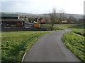
National Cycle Route 55/Holden Lane Working Men's Club
National Cycle Route 55 heading northeast to the rear of Noblett Rd Sneyd Green passes to the rear of Holden Lane Working Men's Club to join onto Ralph Drive at a cycle gate.
Image: © Mike Eardley
Taken: 8 Mar 2007
0.18 miles
3
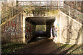
Biddulph Valley Disused Railway (Now Cycle path / Footpath), Milton
Milton Road Passed over the top of the old Railway line which is now a cycle path and footpath along the entire length.
Opened 1859
Closed to Passengers 1927 but used to move freight until 1962
https://en.wikipedia.org/wiki/Biddulph_Valley_line
Image: © Brian Deegan
Taken: 3 Jan 2020
0.19 miles
4
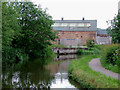
Caldon Canal south of Milton, Stoke-on-Trent
The industrial works are by Redhills Road.
The seventeen mile Caldon Canal was opened from Etruria to Froghall in 1779, and extended to Uttoxeter in 1811, though this extension only operated until the late 1840s. The canal has seventeen locks and the 69 metre long very low Froghall Tunnel, unusable by many narrowboats.
Image: © Roger D Kidd
Taken: 27 May 2011
0.24 miles
5
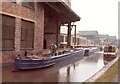
Two unladen Johnson boats at Milton
From about 1970 to 1986, Johnson Brothers' pottery used three boats to carry part-made pottery four miles along the Caldon Canal between two of their sites. This reduced the number of breakages, compared with using lorries. The boats were called Milton Maid, Milton Princess and Milton Queen. For more information, see http://www.thepotteries.org/potworks_wk/087.htm.
Image: © Christine Johnstone
Taken: Unknown
0.24 miles
6
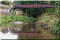
Canal pipe bridge south of Milton, Stoke-on-Trent
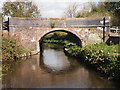
This is the Caldon Canal, Birches Head Road Bridge is No 15 across the Caldon Canal near Abbey Hulton. This bridge has retained its number in the masonry.
Looking north as the Caldon Canal meanders towards Milton, Stockton Brook, Endon, Cheddleton and Froghall.
Image: © Roger Kidd
Taken: 12 Sep 2019
0.24 miles
7

Caldon Canal south of Milton, Stoke-on-Trent
Looking south towards Stoe-on-Trent (Etruria Junction), Redhills Bridge is No 16 across the Caldon Canal.
Image: © Roger Kidd
Taken: 2 Aug 2015
0.24 miles
8

Pipe bridge across the Caldon Canal near Milton
Looking south as the Caldon Canal meanders towards Hanley and Etruria Junction.
Image: © Roger Kidd
Taken: 2 Aug 2015
0.24 miles