
IMAGES TAKEN NEAR TO
North Walls, STAFFORD, ST16 3AD
Introduction
This page details the photographs taken nearby to North Walls, ST16 3AD by members of the Geograph project.
The Geograph project started in 2005 with the aim of publishing, organising and preserving representative images for every square kilometre of Great Britain, Ireland and the Isle of Man.

There are currently over 7.5m images from over14,400 individuals and you can help contribute to the project by visiting https://www.geograph.org.uk
Image Map
Images are licensed for reuse under creativecommons.org/licenses/by-sa/2.0
Notes
- Clicking on the map will re-center to the selected point.
- The higher the marker number, the further away the image location is from the centre of the postcode.
Image Listing (421 Images Found)
Images are licensed for reuse under creativecommons.org/licenses/by-sa/2.0
Image
Details
Distance
1
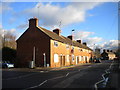
Houses on North Walls, Stafford
A terrace of apparently uninhabited houses on the north eastern edge of Stafford town centre.
Image: © Richard Vince
Taken: 11 Jan 2014
0.04 miles
2

Floods, Kingsmead car park
Stafford suffered little in the floods of 5 -7 September compared to South Wales or the north of England but nobody will be parking here for a while. Interestingly enough this site is one proposed for future development!
Image: © Simon Huguet
Taken: 7 Sep 2008
0.05 miles
3
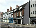
5 Eastgate Street, Stafford
This is the brick faced building, formerly a town house, now retail and office premises. Mid 18th century, apparently retaining considerable original interior construction. Listed Grade II.
Image: © Alan Murray-Rust
Taken: 16 Aug 2017
0.06 miles
4
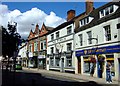
The Sheridan, Eastgate Street, Stafford
Now once again temporarily empty like so many other public houses the 'Firkin' [also recently somewhat sadly titled the 'Forester and Firkin'] is more properly known as 'The Sheridan', named after Richard Brinsley Sheridan, playwright and sometime MP for Stafford.
Image: © Simon Huguet
Taken: 2 Aug 2008
0.06 miles
5
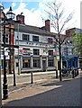
The Firkin (closed), 3 Eastgate Street
This pub had many names over the years, which tends not to be a good sign. It became one of the pubs run by the Firkin Brewery, and was known as The Forester & Firkin. Later it was renamed The Firkin. When photographed in May 2010, it had closed down and was available to rent. Apparently it had closed some time prior to then. As at the end of October 2010, the pub was still on the market for letting.
Image: © P L Chadwick
Taken: 1 May 2010
0.06 miles
6
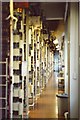
Inside Stafford Castlegate Tandem Exchange
This photo was taken in Jan 1989 inside the Strowger exchange in Stafford. The equipment has sadly long since gone and the building subsequently been converted into accommodation.
Image: © Tim Jenkins
Taken: 6 Jan 1989
0.06 miles
7
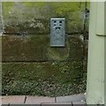
Flush bracket bench mark, Borough Hall, Stafford
See http://www.geograph.org.uk/photo/5504629 for location.
Image: © Alan Murray-Rust
Taken: 16 Aug 2017
0.07 miles
8
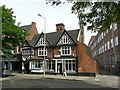
The Colonnade and Tudor House, Eastgate Street, Stafford
Dated 1560 http://www.geograph.org.uk/photo/5504626 on the original jettied gable to the left, the remaining frontage being a late 19th century alteration. Significant timber framing exists to the rear. Listed Grade II.
Image: © Alan Murray-Rust
Taken: 16 Aug 2017
0.07 miles
9
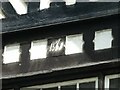
The Colonnade and Tudor House, Eastgate Street, Stafford
Inscribed date on the old gable. See http://www.geograph.org.uk/photo/5504620 for location.
Image: © Alan Murray-Rust
Taken: 16 Aug 2017
0.07 miles
10
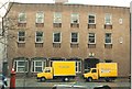
Stafford Castlegate Telephone Exchange
Front of Stafford Castlegate Telephone Exchange on Eastgate Street. The building actually housed a number of different exchanges including a Strowger Tandem unit and a TXE4.
Image: © Tim Jenkins
Taken: Unknown
0.07 miles