
IMAGES TAKEN NEAR TO
Bank Passage, STAFFORD, ST16 2JR
Introduction
This page details the photographs taken nearby to Bank Passage, ST16 2JR by members of the Geograph project.
The Geograph project started in 2005 with the aim of publishing, organising and preserving representative images for every square kilometre of Great Britain, Ireland and the Isle of Man.

There are currently over 7.5m images from over14,400 individuals and you can help contribute to the project by visiting https://www.geograph.org.uk
Image Map
Images are licensed for reuse under creativecommons.org/licenses/by-sa/2.0
Notes
- Clicking on the map will re-center to the selected point.
- The higher the marker number, the further away the image location is from the centre of the postcode.
Image Listing (469 Images Found)
Images are licensed for reuse under creativecommons.org/licenses/by-sa/2.0
Image
Details
Distance
2
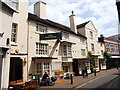
The Vine Hotel, 7 Salter Street
A Marston's house, which is both a hotel and a pub. It was at one time a coaching inn, and is believed to date back to 1487. A Grade II listed building, it is thought to be the oldest of Stafford's pubs.
Image: © P L Chadwick
Taken: 1 May 2010
0.01 miles
3
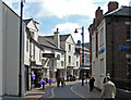
The Vine Hotel, Salter Street, Stafford
The building dates from the 18th century, with later alterations. Listed Grade II.
Image: © Alan Murray-Rust
Taken: 16 Aug 2017
0.01 miles
4
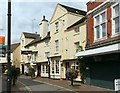
Salter Street from the corner of Bank Passage
The Vine Hotel is one of the older pubs in Stafford and it has been a Hotel since the C16th. Along with the Swan on Greengate Street it was one of the town's main coaching inns during the C18th and C19th.
Image: © Simon Huguet
Taken: 15 Mar 2009
0.01 miles
5
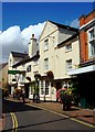
Vine Hotel, Stafford
The Vine has been a Hotel since the C16th. Along with the Swan on Greengate Street it was one of the town's main coaching inns during the C18th and C19th.
Image: © Simon Huguet
Taken: 2 Aug 2008
0.02 miles
6
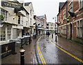
Salter Street
The Vine Hotel is prominent on Salter Street in Stafford's town centre
Image: © Trevor Littlewood
Taken: 23 Dec 2022
0.02 miles
7
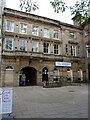
The Stafford Railway Building Society, Market Square
Built in the 1840s and extended to the right about 30 years later, this attracted its Grade II listing https://britishlistedbuildings.co.uk/101289570-stafford-railway-building-society-stafford-forebridge-ward#.YbpUJ73P3IU & https://historicengland.org.uk/listing/the-list/list-entry/1289570 in 1951. The mutual building society has been in business since 1877, and still operates from this site.
Image: © Richard Law
Taken: 4 Nov 2020
0.02 miles
8
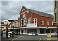
Salter Street with The Malt Mill
The Malt Mill is the name given to the set of apartments in the upper part of the building which was formerly the local Co-operative department store for furniture and bedding. The style of architecture with terracotta dressings suggest a building date of around 1900-10.
Image: © Alan Murray-Rust
Taken: 16 Aug 2017
0.02 miles
9
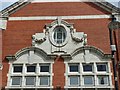
Former Co-operative store, Salter Street
Showing the use of terracotta for detailing and decoration. See http://www.geograph.org.uk/photo/5506636 for location.
Image: © Alan Murray-Rust
Taken: 16 Aug 2017
0.02 miles
10

36 & 37 Gaolgate Street, Stafford
Forming the right-hand side of the same building as Image, these two houses date back internally to the 17th century, where there are some original beams, panelling and pilaster columns. Externally they have been much altered in the meantime. They were collectively Grade II listed https://britishlistedbuildings.co.uk/101289720-36-and-37-gaolgate-street-stafford-forebridge-ward#.YbOMA73P3IU & https://historicengland.org.uk/listing/the-list/list-entry/1289720 in 1971
Image: © Richard Law
Taken: 4 Nov 2020
0.02 miles