
IMAGES TAKEN NEAR TO
Newport Road, STAFFORD, ST16 2EZ
Introduction
This page details the photographs taken nearby to Newport Road, ST16 2EZ by members of the Geograph project.
The Geograph project started in 2005 with the aim of publishing, organising and preserving representative images for every square kilometre of Great Britain, Ireland and the Isle of Man.

There are currently over 7.5m images from over14,400 individuals and you can help contribute to the project by visiting https://www.geograph.org.uk
Image Map
Images are licensed for reuse under creativecommons.org/licenses/by-sa/2.0
Notes
- Clicking on the map will re-center to the selected point.
- The higher the marker number, the further away the image location is from the centre of the postcode.
Image Listing (616 Images Found)
Images are licensed for reuse under creativecommons.org/licenses/by-sa/2.0
Image
Details
Distance
1
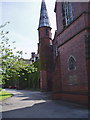
Chetwynd Centre, Stafford
In its first incarnation, it was the King Edward VI Grammar School, Stafford
Image: © Eirian Evans
Taken: 5 Jun 2006
0.02 miles
2
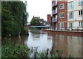
Nervous times.
Although the floods of 5-7 September left Stafford relatively unscathed the residents of this new development right by the River Sow must have been a bit nervous for a while.
Image: © Simon Huguet
Taken: 7 Sep 2008
0.03 miles
3
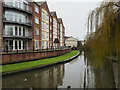
River Sow passing apartment block
The river here is just south of the town centre in Stafford. The apartments are at Riverside Mews.
Image: © Trevor Littlewood
Taken: 23 Dec 2022
0.03 miles
4
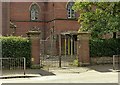
Gateway of former King Edward VI School, Stafford
Erected as part of the 1928 development of the school, Listed Grade II separately from the main building.
Image: © Alan Murray-Rust
Taken: 23 Aug 2017
0.03 miles
6
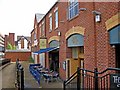
The Yard (1), Unit B, Espley's Yard, Stafford Riverside
The Yard is a modern pub overlooking the River Sow. It is a Smith & Jones pub, which is one of the brands of the Barracuda Group, which was formed in 2000. They now own over 200 managed pubs across England, Scotland and Wales.
Image
Image: © P L Chadwick
Taken: 1 May 2010
0.04 miles
7

The Yard (2), Unit B, Espley's Yard, Stafford Riverside
Another view of this Smith & Jones pub. In the foreground is part of the footbridge across the River Sow from Mill Bank.
Image
Image: © P L Chadwick
Taken: 1 May 2010
0.04 miles
8
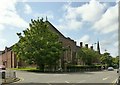
Former King Edward VI School, Stafford
A complex of buildings built between 1860 and 1928. The oldest section is that with the chimneys and spire. The nearer end with the octagonal assembly hall and classroom range to the left constitutes the final 1928 expansion. Listed Grade II.
Later functioning under the name of The Chetwynd Centre, it was unoccupied when photographed, with a potential for conversion to residential use.
Image: © Alan Murray-Rust
Taken: 23 Aug 2017
0.04 miles
9

Chapel roof of Chetwynd Centre Stafford under renewal
The Chetwynd Centre is a grade II listed former educational centre previously owned by a trust and operated by Staffordshire Education Committee in various roles as school, college and sixth form centre. It has been sold for residential development. The roof over the former chapel is being renewed. The building has been rebranded as Chetwynd Court.
Image: © Rod Grealish
Taken: 25 Jul 2025
0.04 miles
10

The Picture House
A very old cinema, dating from before 1914. Much loved by generations of Staffordians. Now another 'Wetherspoons'.
Image: © Simon Huguet
Taken: 12 Apr 2008
0.04 miles