
IMAGES TAKEN NEAR TO
Hurricane Close, STAFFORD, ST16 1GZ
Introduction
This page details the photographs taken nearby to Hurricane Close, ST16 1GZ by members of the Geograph project.
The Geograph project started in 2005 with the aim of publishing, organising and preserving representative images for every square kilometre of Great Britain, Ireland and the Isle of Man.

There are currently over 7.5m images from over14,400 individuals and you can help contribute to the project by visiting https://www.geograph.org.uk
Image Map
Images are licensed for reuse under creativecommons.org/licenses/by-sa/2.0
Notes
- Clicking on the map will re-center to the selected point.
- The higher the marker number, the further away the image location is from the centre of the postcode.
Image Listing (37 Images Found)
Images are licensed for reuse under creativecommons.org/licenses/by-sa/2.0
Image
Details
Distance
1
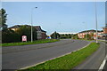
View along Mustang Drive Stafford an access route to the Prime Point business park
This is the main access route to the Prime Point business park. The roads on the estate and adjoining business estates are named for military aircraft of WWII, The Premier Inn on the left is one of two on the estate, the other being to the right but off-camera. The white building in the background is one of three Screwfix Distribution centres
Image: © Rod Grealish
Taken: 17 Oct 2023
0.04 miles
2
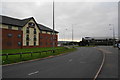
Mustang Drive
The entrance to the Business Park.
Image: © Bill Boaden
Taken: 20 Sep 2013
0.04 miles
3
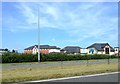
Motels and Restaurants, Primepoint 14, Stafford
As well as the huge industrial units of Primepoint 14 the northern skyline of Stafford has grown a group of Motels, pubs and restaurants.
Image: © Simon Huguet
Taken: 26 Jul 2008
0.05 miles
4
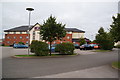
Premier Inn, Stafford North
One of two parts, each side of Mustang Drive.
Image: © Bill Boaden
Taken: 20 Sep 2013
0.06 miles
5
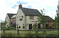
The Shire Horse Inn
A traditional old inn built in 2002 for Chef and Brewer.
Image: © Neil Lewin
Taken: 11 Aug 2006
0.06 miles
6
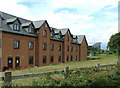
Premier Travel Inn 'Hurricane'
So named as it is on Hurricane Way, it is right next to the Shire Horse Inn. The futuristic building behind is an Audi showroom.
Image: © Neil Lewin
Taken: 11 Aug 2006
0.06 miles
7

Shackleton Way, Stafford
Shackleton Way leads off Mustang Drive and is part of an extensive business park on the northern edge of Stafford, off the A34. No doubt the proximity to junction 14 on the M6 was a major factor in its development. In this view Gibson House is home to Deans, an accountancy firm; beyond that is the turn for Hurricane Close.
Image: © Stephen McKay
Taken: 24 Sep 2020
0.07 miles
8
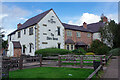
The Shire Horse, Stafford
This pub, part of the Chef & Brewer chain, was purpose built in 2002 but has been designed to have a traditional 'country pub' feel. It is pretty much surrounded by a business park and is convenient for the M6.
Image: © Stephen McKay
Taken: 24 Sep 2020
0.07 miles
9
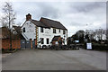
The Shire Horse, Stafford
Chef and Brewer restaurant attached to the Stafford North (Hurricane) Premier Inn.
Image: © David Dixon
Taken: 4 Feb 2019
0.07 miles
10
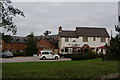
The Shire Horse, Stafford
A new pub on a new business park, built to suggest it is traditional. There is part of a large Premier Inn behind.
Image: © Bill Boaden
Taken: 20 Sep 2013
0.07 miles