
IMAGES TAKEN NEAR TO
Denbigh Street, STOKE-ON-TRENT, ST1 5JB
Introduction
This page details the photographs taken nearby to Denbigh Street, ST1 5JB by members of the Geograph project.
The Geograph project started in 2005 with the aim of publishing, organising and preserving representative images for every square kilometre of Great Britain, Ireland and the Isle of Man.

There are currently over 7.5m images from over14,400 individuals and you can help contribute to the project by visiting https://www.geograph.org.uk
Image Map
Images are licensed for reuse under creativecommons.org/licenses/by-sa/2.0
Notes
- Clicking on the map will re-center to the selected point.
- The higher the marker number, the further away the image location is from the centre of the postcode.
Image Listing (32 Images Found)
Images are licensed for reuse under creativecommons.org/licenses/by-sa/2.0
Image
Details
Distance
1
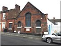
Hanley: remains of Methodist New Connexion church on Lowther Street
The church on the corner of Portland Street and Lowther Street was mostly demolished in 2011: the vacant lot can be seen behind the car on the right. All that remains are the Sunday School rooms. The inscribed stone below the central window reads:
METHODIST
NEW CONNEXION.
1876
Image: © Jonathan Hutchins
Taken: 24 Sep 2016
0.03 miles
2
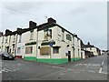
Portland Inn, Hanley
On the corner of Portland Street and Century Street (formerly Brook Street), the pub is closed and boarded up.
Image: © Jonathan Hutchins
Taken: 24 Sep 2016
0.04 miles
3
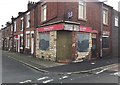
Hanley: Horton's Stores on the corner of Denbigh Street
Another casualty of the Renew North Staffordshire regeneration programme, halted by Government cuts in 2011.
Image: © Jonathan Hutchins
Taken: 24 Sep 2016
0.04 miles
5
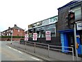
Hanley: store on corner of Century Street and A53
BKB stands for Bedrooms Kitchens and Bathrooms. This site was formerly a showroom for Streben used cars, the main office of which was on the other side of the A53 - see http://www.geograph.org.uk/photo/5143780
Image: © Jonathan Hutchins
Taken: 24 Sep 2016
0.15 miles
7
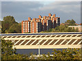
Factory rooftop and apartments, Stoke-on-Trent
A telephoto assisted image, looking north-east from the footbridge across Festival Way.
The foreground rooftop is of the Brown McFarlane steel works. Further away are the red-brick apartment blocks* in Union Street, half a mile away, north of the Potteries Shopping Centre in Hanley.
*Forest Court, Brookfield Court and Boundary Court.
Image: © Roger Kidd
Taken: 11 Sep 2019
0.16 miles
8
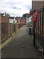
Hanley: alley off Portland Street
Image: © Jonathan Hutchins
Taken: 24 Sep 2016
0.17 miles
9
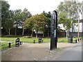
Hanley: footpath off the A50
Designated as 'Etruria Loop Line'.
Image: © Jonathan Hutchins
Taken: 24 Sep 2016
0.17 miles
10
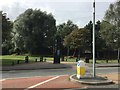
Footpath off the A50 Waterloo Road in Stoke
Designated as 'Etruria Loop Line'. On the opposite side of the road is http://www.geograph.org.uk/photo/5142759
Image: © Jonathan Hutchins
Taken: 24 Sep 2016
0.17 miles