
IMAGES TAKEN NEAR TO
Longton Road, STONE, ST15 8SY
Introduction
This page details the photographs taken nearby to Longton Road, ST15 8SY by members of the Geograph project.
The Geograph project started in 2005 with the aim of publishing, organising and preserving representative images for every square kilometre of Great Britain, Ireland and the Isle of Man.

There are currently over 7.5m images from over14,400 individuals and you can help contribute to the project by visiting https://www.geograph.org.uk
Image Map
Images are licensed for reuse under creativecommons.org/licenses/by-sa/2.0
Notes
- Clicking on the map will re-center to the selected point.
- The higher the marker number, the further away the image location is from the centre of the postcode.
Image Listing (12 Images Found)
Images are licensed for reuse under creativecommons.org/licenses/by-sa/2.0
Image
Details
Distance
1
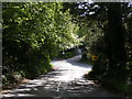
Shaded Junction
A lane joins the A520 road near Oulton.
Image: © Gordon Griffiths
Taken: 30 May 2010
0.03 miles
2
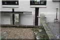
Hayes Mill - Thingumajig
These are actually "button hole launders" - one term for them. The holes would all be plugged with removable bungs and a suspension of solid and liquid would be filled in to the settling ark behind. As the solid settled the supernatant would be run off by withdrawing plugs from above down. Quite common in the bone and stone industry. An example is also to be found at Thwaite Putty Mill, Leeds. Note the adaptive reuse by using one hole for a pipe.
Image: © Chris Allen
Taken: 26 Jan 2008
0.05 miles
3
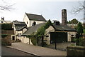
Hayes Mill
Moddershall Valley mill, one of six survivors. Nice chimney but wheel not visible from public area.
Image: © Chris Allen
Taken: 26 Jan 2008
0.06 miles
4
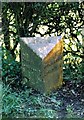
Old Milepost by the A520, Oultoncross, Stone parish
Cast iron post by the A520, in parish of STONE (STAFFORD District), near Oultoncross junction, in front of hedge, on Southeast side of road. Lathe iron casting, erected by the County Council in the 19th/20th century.
Inscription reads:-
: STONE 1 / STAFFORD 8 : : STONE : : ROUGH CLOSE 3 / LONGTON 6 :
Maker:-
: Chas. Lathe, Tipton. :
Staffordshire HER.
HER Number: 51347 https://www.heritagegateway.org.uk/Gateway/Results_Single.aspx?uid=MST12571&resourceID=1010
Milestone Society National ID: ST_STLT08.
Image: © J Higgins
Taken: 1 Jan 2000
0.07 miles
5
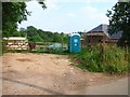
Building in progress, Oulton
Whilst this house is being built or rebuilt, the owners are living in a caravan and using the portaloo
Image: © Oliver Dixon
Taken: 30 Jun 2006
0.11 miles
6
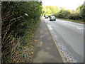
Traffic on the A520
Main road from Stone to Meir
Image: © Peter Fleming
Taken: 17 Oct 2007
0.11 miles
7
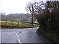
Nicholl's Lane Junction
The junction with Church Lane, Oulton.
Image: © Gordon Griffiths
Taken: 5 Feb 2010
0.12 miles
8
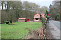
Site of Stone water Works.
The book Industrial Archaeology of North Staffordshire by W J Thompson (not dated) shows a fine steam pumping station with a tall chimney. I reckon this was on the grassy area. The distant house is called "Pump House" and would have been the superintendent's house. The architecture is municipal and there is a water authority keep out sign. A rapidly moving automobile has activated the automatic slow down sign.
Image: © Chris Allen
Taken: 26 Jan 2008
0.16 miles
9
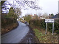
Entering Oulton
The view up Church Lane, Oulton.
Image: © Gordon Griffiths
Taken: 5 Feb 2010
0.17 miles
10
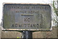
Redundant sign
The building that this pertained too is long gone - Stone Water Works.
Image: © Chris Allen
Taken: 26 Jan 2008
0.17 miles