IMAGES TAKEN NEAR TO
Whitesytch Lane, STONE, ST15 8RD

Introduction

This page details the photographs taken nearby to Whitesytch Lane, ST15 8RD by members of the Geograph project.

The Geograph project started in 2005 with the aim of publishing, organising and preserving representative images for every square kilometre of Great Britain, Ireland and the Isle of Man.

There are currently over 7.5m images from over14,400 individuals and you can help contribute to the project by visiting https://www.geograph.org.uk

Image Map


Images are licensed for reuse under creativecommons.org/licenses/by-sa/2.0
Notes
  • Clicking on the map will re-center to the selected point.
  • The higher the marker number, the further away the image location is from the centre of the postcode.

Image Listing (2 Images Found)

Images are licensed for reuse under creativecommons.org/licenses/by-sa/2.0
Image
Details
Distance
1
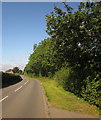
B5066 approaching Hilderstone
Sandon Road, seen near Rose Cottage.
Image: © Derek Harper Taken: 7 Sep 2012
0.17 miles
2
Mill House
Mill House is a grade-2 listed building, also known as "Stone's Throw". The Hilderstone Conservation Area Appraisal describes it thus: "This late 18th century house has an asymmetrical four-bay frontage suggesting an evolution from an earlier building. To the right is the plain elevation of a former outbuilding, which serves as a prominent reminder of the agricultural and industrial origins of the village. Its white painted rendered elevations are a recent replacement for roughcast and give it an air of status".
Image: © Ian Calderwood Taken: 26 Oct 2015
0.23 miles