
IMAGES TAKEN NEAR TO
Dorney Close, STONE, ST15 0GS
Introduction
This page details the photographs taken nearby to Dorney Close, ST15 0GS by members of the Geograph project.
The Geograph project started in 2005 with the aim of publishing, organising and preserving representative images for every square kilometre of Great Britain, Ireland and the Isle of Man.

There are currently over 7.5m images from over14,400 individuals and you can help contribute to the project by visiting https://www.geograph.org.uk
Image Map
Images are licensed for reuse under creativecommons.org/licenses/by-sa/2.0
Notes
- Clicking on the map will re-center to the selected point.
- The higher the marker number, the further away the image location is from the centre of the postcode.
Image Listing (5 Images Found)
Images are licensed for reuse under creativecommons.org/licenses/by-sa/2.0
Image
Details
Distance
1

Yarnfield Park training centre
Formerly a British Telecoms training centre, Yarnfield Park is becoming a major training and conference facility used by a variety of organisations.
Image: © Peter Mackenzie
Taken: 25 Apr 2017
0.12 miles
2

A Part of the Yarnfield Park Training & Conference Centre
This complex covers over 80 acres of beautiful Staffordshire countryside, Yarnfield Park offers a unique venue perfect for conferences, training and events. http://www.yarnfieldpark.com/index.htm?id=index
Image: © Mick Malpass
Taken: 1 Dec 2011
0.13 miles
3

Yarnfield Park
Originally the site was known as Beatty Hall accommodation camp serving the Cold Meece munitions factory. The then GPO opened a training school after the war on the 80 acre site. GPO became British Telecom in 1984 and it remained a dedicated British Telecom training centre until the summer of 2010 when it was a commercial conference and training centre with over 40 event spaces and 338 bedrooms. The centre is now privately owned.
Image: © Jo and Steve Turner
Taken: 15 Mar 2004
0.16 miles
4
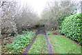
Highlows Lane, Yarnfield
Highlows Lane going out of Yarnfield. The lane and public footpath lead to Swynnerton across very boggy ground.
Image: © Stephen Pearce
Taken: 29 Nov 2006
0.22 miles
5
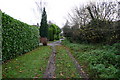
Highlows Lane, Yarnfield
This is Highlows Lane at the start (or end) of a public footpath to and from Swynnerton looking towards Yarnfield.
Image: © Stephen Pearce
Taken: 29 Nov 2006
0.22 miles