IMAGES TAKEN NEAR TO
Geoff Morrison Way, UTTOXETER, ST14 7SR
Introduction
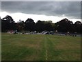
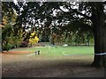
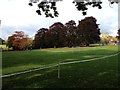
This page details the photographs taken nearby to Geoff Morrison Way, ST14 7SR by members of the Geograph project.
The Geograph project started in 2005 with the aim of publishing, organising and preserving representative images for every square kilometre of Great Britain, Ireland and the Isle of Man.

There are currently over 7.5m images from over14,400 individuals and you can help contribute to the project by visiting https://www.geograph.org.uk
Image Map
Images are licensed for reuse under creativecommons.org/licenses/by-sa/2.0
Notes
- Clicking on the map will re-center to the selected point.
- The higher the marker number, the further away the image location is from the centre of the postcode.
Image Listing (11 Images Found)
Images are licensed for reuse under creativecommons.org/licenses/by-sa/2.0
Image
Details
Distance
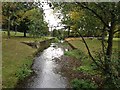
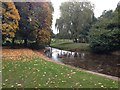
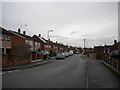
7

Bramshall Road
Looking away from Uttoxeter along the B5027 Bramshall Road. It is the first bright cloudless sky we have had for about ten days.
Image: © Malcolm Neal
Taken: 17 Jan 2022
0.19 miles