
IMAGES TAKEN NEAR TO
Greenfields, UTTOXETER, ST14 5DQ
Introduction
This page details the photographs taken nearby to Greenfields, ST14 5DQ by members of the Geograph project.
The Geograph project started in 2005 with the aim of publishing, organising and preserving representative images for every square kilometre of Great Britain, Ireland and the Isle of Man.

There are currently over 7.5m images from over14,400 individuals and you can help contribute to the project by visiting https://www.geograph.org.uk
Image Map
Images are licensed for reuse under creativecommons.org/licenses/by-sa/2.0
Notes
- Clicking on the map will re-center to the selected point.
- The higher the marker number, the further away the image location is from the centre of the postcode.
Image Listing (35 Images Found)
Images are licensed for reuse under creativecommons.org/licenses/by-sa/2.0
Image
Details
Distance
1

Houses on Greenfields
Greenfields appears to be the name of this little cul-de-sac just off the B5032.
Image: © Malcolm Neal
Taken: 17 Jan 2022
0.02 miles
2
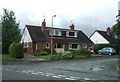
Houses on Greenfields, Denstone
Off Denstone Lane.
Image: © JThomas
Taken: 20 Jun 2015
0.03 miles
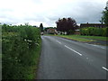
4
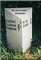
Old Milepost by the B5032, Denstone
Cochrane iron casting by the B5032, in parish of Denstone (East Staffordshire District), Denstone, in hedge, North side of road.
Inscription reads:-
: DENSTONE ½ / ELLASTONE 2¼ / ASHBOURNE 7 : : DENSTONE / PARISH 2: : ALTON 2 / CHEADLE 6 :
Maker:-
: Cochrane & Co, Dudley. :
Grade II listed.
List Entry Number: 1392680 https://historicengland.org.uk/listing/the-list/list-entry/1392680
Surveyed
Milestone Society National ID: ST_abcd07
Image: © Milestone Society
Taken: Unknown
0.06 miles
5
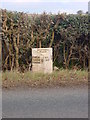
Mile Post on the edge of Denstone
The Mile Post is on the B5032 and gives the following distances. Denstone -half a mile, Ellastone 2 and a quarter, Ashbourne 7, and going the other direction Alton 2 and Cheadle 6.
Image: © Linda Bailey
Taken: 1 Jan 2006
0.07 miles
6
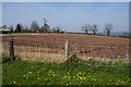
Ploughed field on the edge of Denstone
A lot of new housing development has taken place off to the left.
Image: © Bill Boaden
Taken: 29 Mar 2014
0.07 miles
7
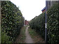
Public footpath off Marlpit Lane, Denstone
Leading to The Weavers and Denstone Lane.
Image: © Richard Vince
Taken: 20 Aug 2022
0.09 miles
8
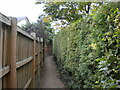
Public footpath off Denstone Lane, Denstone (2)
Leading to The Weavers and Marlpit Lane.
Image: © Richard Vince
Taken: 20 Aug 2022
0.09 miles
9
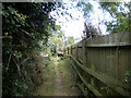
Public footpath off Denstone Lane, Denstone (1)
Signposted to Alton, which is reached by a path to which it connects.
Image: © Richard Vince
Taken: 20 Aug 2022
0.12 miles
10
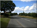
Denstone Lane, Denstone
The B5032 along the northern edge of the village, looking towards Alton and Cheadle.
Image: © Richard Vince
Taken: 20 Aug 2022
0.13 miles