
IMAGES TAKEN NEAR TO
Lower Bethesda Street, STOKE-ON-TRENT, ST1 3RP
Introduction
This page details the photographs taken nearby to Lower Bethesda Street, ST1 3RP by members of the Geograph project.
The Geograph project started in 2005 with the aim of publishing, organising and preserving representative images for every square kilometre of Great Britain, Ireland and the Isle of Man.

There are currently over 7.5m images from over14,400 individuals and you can help contribute to the project by visiting https://www.geograph.org.uk
Image Map
Images are licensed for reuse under creativecommons.org/licenses/by-sa/2.0
Notes
- Clicking on the map will re-center to the selected point.
- The higher the marker number, the further away the image location is from the centre of the postcode.
Image Listing (192 Images Found)
Images are licensed for reuse under creativecommons.org/licenses/by-sa/2.0
Image
Details
Distance
1

The Old Fire Station (now gone), Hanley
The old Fire Station before it was demolished and replaced.
Image: © Brian Deegan
Taken: 11 Apr 2010
0.02 miles
2
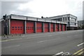
Hanley fire station
Hanley fire station, Lower Bethesda Street, Hanley, Staffordshire.
Image: © Kevin Hale
Taken: 21 Oct 2006
0.02 miles
3
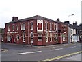
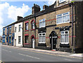
The Smithfield public house, Hanley
Lower Bethesda Street
On the 1898 OS map - opposite The Smithfield, at the junction of Regent Road & Bethesda Street was a Cattle Market.
Smithfield was originally, an open area outside the North West walls of the City of London, a market for cattle and horses, which later became the central meat-market - no doubt this is where The Smithfield public house gets its name from
Image: © Steven Birks
Taken: 16 Sep 1999
0.04 miles
5
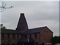
Former Smithfield Pottery & Bottle Oven
Smithfield Pottery , Hanley a grade II* listed building now situated on The Potteries Way (ring road around Hanley).
Late 19thC brick, slate roofs, single ridge and two gable ends.
Image: © Steven Birks
Taken: Unknown
0.06 miles
7
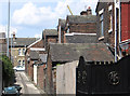
Hanley - service road off Jasper Street
Viewed from Regent Road.
Image: © Dave Bevis
Taken: 18 Jun 2012
0.07 miles
8
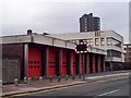
Hanley Fire Station
Lower Bethesda Street, Hanley.
In the background is Unity House before it was demolished. http://www.geograph.org.uk/photo/343830
Image: © Steven Birks
Taken: 16 Sep 1999
0.07 miles
9
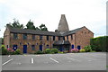
Former Smithfield pottery, Hanley
Now offices with a nicely preserved bottle oven.
This site marked the end of a project I started in 1989 to photograph all the surviving bottle kilns in Stoke. Only one has been demolished since then and I photographed it at the beginning.
Image: © Chris Allen
Taken: 1 Aug 2010
0.07 miles
10
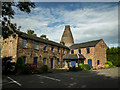
Enclosed Bottle Kiln (Smithfield Pottery), Hanley
An enclosed bottle kiln (1880) at the former Smithfield Pottery, now situated on The Potteries Way (ring road around Hanley).
http://www.thepotteries.org/listed/59a.html
Image: © Brian Deegan
Taken: 2 Sep 2007
0.07 miles