
IMAGES TAKEN NEAR TO
Cresswell Road, STOKE-ON-TRENT, ST1 3PA
Introduction
This page details the photographs taken nearby to Cresswell Road, ST1 3PA by members of the Geograph project.
The Geograph project started in 2005 with the aim of publishing, organising and preserving representative images for every square kilometre of Great Britain, Ireland and the Isle of Man.

There are currently over 7.5m images from over14,400 individuals and you can help contribute to the project by visiting https://www.geograph.org.uk
Image Map
Images are licensed for reuse under creativecommons.org/licenses/by-sa/2.0
Notes
- Clicking on the map will re-center to the selected point.
- The higher the marker number, the further away the image location is from the centre of the postcode.
Image Listing (68 Images Found)
Images are licensed for reuse under creativecommons.org/licenses/by-sa/2.0
Image
Details
Distance
1
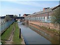
Caldon Canal at Ivy House
Photo taken from the Bridge on Ivy House Road, Hanley.
In the far distance is Unity House.
The building to the right is J & G Meakin's Eagle pottery works.
See the area after demolition of Meakins:- http://www.geograph.org.uk/photo/343834
See the bridge the photo was taken from:- http://www.geograph.org.uk/photo/344576
Image: © Steven Birks
Taken: 28 May 2004
0.10 miles
2
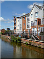
New apartments east of Hanley, Stoke-on-Trent
Many nearby former industrial areas, long demolished and cleared out, have now been redeveloped with housing. This 2014-2015 canal-side development is part of the Ivy House Mills development by Lock Keepers Way. (There is no lock nearby).
The Ivy House Lift Bridge (No 11) across the Caldon Canal is nearby.
Image: © Roger D Kidd
Taken: 31 Jul 2015
0.11 miles
3
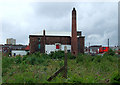
Derelict land east of Hanley, Stoke-on-Trent
An enormous amount of regeneration is being carried out on land formerly covered by industry dating from the late eighteenth and nineteenth centuries. This site, seen from the Caldon canal, will soon be redeveloped.
Image: © Roger D Kidd
Taken: 27 May 2011
0.11 miles
4
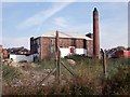
Ivy House Mill
This warehouse and chimney is all that remains of the Tullis Russell Brittain's paper mill which has been here since 1834. The mill produced wrapping paper and high quality transfer paper for the pottery industry. It shut down in 2006, when production was transferred to Korea. The building is to be converted for residential use, with the chimney retained as a feature.
Image: © Ian Calderwood
Taken: 1 Oct 2011
0.11 miles
5
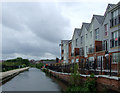
Caldon Canal east of Hanley, Stoke-on-Trent
This image shows the present state of regeneration by the canal west of Ivy House Bridge. The housing on the right is very recent, and ex-factory land has been cleared on both sides ready for further development. Image]
The Caldon Branch of the Trent and Mersey Canal opened in 1779. It runs eighteen miles from Etruria in Stoke-on-Trent, where it leaves the Trent and Mersey Canal. It terminates at Froghall about five miles south-east of Cheddleton. The canal has seventeen locks and the 69 metre long very low Froghall Tunnel, unusable by many narrowboats. The canal did originally continue through to Uttoxeter, but the section beyond Froghall was closed by the late 1840s, much of its course being filled in to construct a railway.
Image: © Roger D Kidd
Taken: 27 May 2011
0.12 miles
6
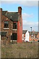
House awaiting demolition
On the corner of Tintern Street and Waterloo Street. A view of the rear of the house only possible because of the previous demolition of the houses on Balfour Street from where this was taken. The houses to the south on Tintern Street have also already gone.
Image: © David Lally
Taken: 20 Mar 2012
0.12 miles
7
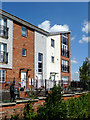
New apartments east of Hanley, Stoke-on-Trent
Many nearby former industrial areas, long demolished and cleared out, have now been redeveloped with housing. This 2014-2015 canal-side development is part of the Ivy House Mills development by Lock Keepers Way. (There is no lock nearby).
The Ivy House Lift Bridge is adjacent, just off to the right.
Image: © Roger D Kidd
Taken: 31 Jul 2015
0.12 miles
8
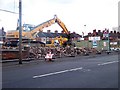
Regeneration? Bucknall New Road, Hanley
Looking across to the south side of the road at what was once terraced buildings. The row was between Homer Street, (off left side of photo) and Eagle Street (off right side of photo).
Image: © Carl Farnell
Taken: 11 Jun 2011
0.12 miles
9
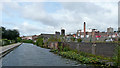
Caldon Canal east of Hanley in Stoke-on-Trent
Old industrial areas by the Caldon Canal are gradually being cleared ready for redevelopment as housing.
Image: © Roger Kidd
Taken: 4 Sep 2009
0.12 miles
10
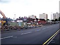
Regeneration? Bucknall New Road, Hanley
Looking across to the south side of the road at what was once terraced buildings. The centre right of the shot shows the entrance to Eagle Street. The school in the background is Hanley St Luke's C of E Aided Primary School on Wellington Road, but that is in the next grid west Image
Image: © Carl Farnell
Taken: 11 Jun 2011
0.12 miles