
IMAGES TAKEN NEAR TO
Buxton Road, LEEK, ST13 8TG
Introduction
This page details the photographs taken nearby to Buxton Road, ST13 8TG by members of the Geograph project.
The Geograph project started in 2005 with the aim of publishing, organising and preserving representative images for every square kilometre of Great Britain, Ireland and the Isle of Man.

There are currently over 7.5m images from over14,400 individuals and you can help contribute to the project by visiting https://www.geograph.org.uk
Image Map
Images are licensed for reuse under creativecommons.org/licenses/by-sa/2.0
Notes
- Clicking on the map will re-center to the selected point.
- The higher the marker number, the further away the image location is from the centre of the postcode.
Image Listing (8 Images Found)
Images are licensed for reuse under creativecommons.org/licenses/by-sa/2.0
Image
Details
Distance
3
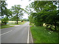
The Edge End milepost in its setting
Beside the A53, and more or less opposite the entrance to the Leek water treatment works.
Image: © Richard Law
Taken: 17 Jun 2009
0.11 miles
4
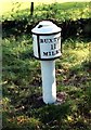
Old Milepost by the A53, Buxton Road, Leek Parish
The milestone is located north west of Haregate, on the verge in front of drystone wall and hedge, on the south east side of road. Parish of Leek (Staffordshire Moorlands District). Cast iron post, green iron bobbin design, erected by the Leek & Hassop, Middlehills & Buxton turnpike trust in the 19th century. The milestone appears to have been relocated from the farm junction further North.
Inscription reads:- : LEEK / 1 / MILE : : BUXTON / 11 / MILES : : WM GREEN. MACCLESFIELD :
Grade II Listed. List Entry Number: 1268634
https://historicengland.org.uk/listing/the-list/list-entry/1268634
Milestone Society National ID: ST_LKBX01
Image: © J Higgins
Taken: Unknown
0.11 miles
5
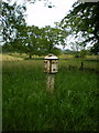
Edge End milepost detail
One of a small number of cast iron mileposts along the Leek to Buxton road, most of which are in much the same parlous state as this one.
Image: © Richard Law
Taken: 17 Jun 2009
0.11 miles
6
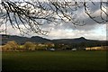
Looking over fields to Edge End Farm
The distinctive rock formations of Hen Cloud and Ramshaw Rocks are on the skyline.
Image: © Graham Hogg
Taken: 5 Dec 2012
0.16 miles
7
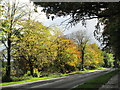
Autumn colours on the A53 near Leek
Trees along the A53, seen from the entrance to Buxton Road Cemetery.
Image: © David Weston
Taken: 26 Oct 2013
0.21 miles
8
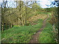
Narrow bridge beside the road to Thorncliffe
This narrow path, and a bridge over the stream, lie beside the modern lane up from Haregate to Thorncliffe. It's well-used by horseriders, but not much else.
Image: © Richard Law
Taken: 4 May 2010
0.22 miles