
IMAGES TAKEN NEAR TO
Onecote, LEEK, ST13 7RG
Introduction
This page details the photographs taken nearby to ST13 7RG by members of the Geograph project.
The Geograph project started in 2005 with the aim of publishing, organising and preserving representative images for every square kilometre of Great Britain, Ireland and the Isle of Man.

There are currently over 7.5m images from over14,400 individuals and you can help contribute to the project by visiting https://www.geograph.org.uk
Image Map
Images are licensed for reuse under creativecommons.org/licenses/by-sa/2.0
Notes
- Clicking on the map will re-center to the selected point.
- The higher the marker number, the further away the image location is from the centre of the postcode.
Image Listing (20 Images Found)
Images are licensed for reuse under creativecommons.org/licenses/by-sa/2.0
Image
Details
Distance

2

Old Milepost by the B5053, Onecote parish
Cast iron post by the B5053, in parish of ONECOTE (STAFFORDSHIRE MOORLANDS District), Onecote village, 30m South of Fold Farmhouse, in grass in front of drystone wall, on Northwest side of road. Lathe iron casting, erected by the County Council in the 19th/20th century.
Inscription reads:-
: WARSLOW 3¼ / LONGNOR 7½ / BUXTON 13½ : : ONECOTE : : IPSTONES 4 / FROGHALL 6 / LEEK 6½ / CHEADLE 9 :
Maker:-
: Chas. Lathe, Tipton. :
Grade II listed.
List Entry Number: 1038176 https://historicengland.org.uk/listing/the-list/list-entry/1038176
Milestone Society National ID: ST_CDBX09.
Image: © J Higgins
Taken: 1 Jan 2000
0.05 miles
3
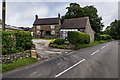
Old Mile Post, Onecote
Grade II listed
Image: © Brian Deegan
Taken: 16 Jul 2020
0.05 miles
4

Newfold
A modern house (a stone dates it to 2006) viewed through a nearby wall stile on the Hamps Way footpath
Image: © Graham Hogg
Taken: 22 Sep 2014
0.10 miles


8
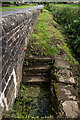
The old Village Well, Onecote
There were two wells, the other was near the Church which has been filled in.
https://en.wikipedia.org/wiki/Onecote
Image: © Brian Deegan
Taken: 16 Jul 2020
0.14 miles

10

River Hamps and Bridge, Onecote
The bridge is Grade II Listed.
The bridge carries the B5053 road over the River Hamps. It is in stone and consists of a single semi-elliptical arch. The bridge has a parapet band and a plain parapet.
Image: © Brian Deegan
Taken: 16 Jul 2020
0.17 miles