
IMAGES TAKEN NEAR TO
Winkhill, LEEK, ST13 7QU
Introduction
This page details the photographs taken nearby to ST13 7QU by members of the Geograph project.
The Geograph project started in 2005 with the aim of publishing, organising and preserving representative images for every square kilometre of Great Britain, Ireland and the Isle of Man.

There are currently over 7.5m images from over14,400 individuals and you can help contribute to the project by visiting https://www.geograph.org.uk
Image Map
Images are licensed for reuse under creativecommons.org/licenses/by-sa/2.0
Notes
- Clicking on the map will re-center to the selected point.
- The higher the marker number, the further away the image location is from the centre of the postcode.
Image Listing (19 Images Found)
Images are licensed for reuse under creativecommons.org/licenses/by-sa/2.0
Image
Details
Distance
1
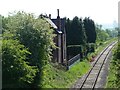
Station House, Winkhill
On the Cauldon Lowe branch, now used by the Churnet Valley Railway.
Image: © Christine Johnstone
Taken: 27 May 2012
0.00 miles
3
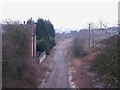
Empty track bed at Winkhill Station
In early 2014, the track between the former Ipstones Station and Cauldon Lowe was lifted, in preparation for re-laying with new track that could carry heavy freight trains. Unfortunately, the merger between Lafarge and Tarmac that occurred around the same time resulted in a government enquiry into a possible unhealthy monopoly. In the mean time, the railway scheme was suspended.
Image: © Ian Calderwood
Taken: 18 Jan 2015
0.01 miles
4
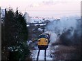
Class 37 on the reopened Cauldon Lowe Branch
In 2010, the Cauldon Lowe Branch Line was restored and reopened. A series of gala events were held to celebrate, including a diesel gala. The train in the picture is just passing through the site of Winkhill Station. Cauldon Cement Works is in the background.
Image: © Ian Calderwood
Taken: 27 Nov 2010
0.02 miles
5
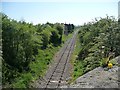
The Cauldon Lowe branch
No longer mothballed as in Image, but used by the Churnet Valley Railway.
Image: © Christine Johnstone
Taken: 27 May 2012
0.03 miles
6
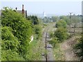
Mineral Railway
This branch of the North Staffordshire Railway was built in the early 1900s to serve the limestone quarries at Caldon Low. Although it is currently disused, the track has not been removed and the line is technically only "mothballed". A passenger service also ran down a branch to Waterhouses, where it linked with the Manifold Light Railway. The house, to the left, is called Station House and is at the location of Winkhill Halt. The white tower in the background is the cement works at Cauldon Lowe.
Image: © Ian Calderwood
Taken: 5 May 2007
0.05 miles
8
![The Casey [causeway] meets Ellaston Road](https://s0.geograph.org.uk/geophotos/02/96/67/2966768_89adc5ac_120x120.jpg)
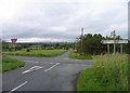
The Casey [causeway] meets Ellaston Road
At the 273 metre spot height.
Image: © Christine Johnstone
Taken: 27 May 2012
0.06 miles
9
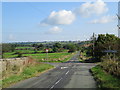
Crossroads near Winkhill
Looking along The Casey (between Foxt and Winkhill) at the crossing with Ellastone Road. The road also bridges the railway line between Leekbrook and Cauldon Lowe: the stone wall on the left is the parapet of the bridge. The railway track of this section has been removed.
Image: © David Weston
Taken: 21 Sep 2014
0.06 miles
10
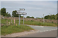
Winkhill Station crossroads
Roads meet on the bridge over the disused railway to Waterhouses. The modern signpost is informative, but much less attractive than its traditional forebears.
Image: © Alan Murray-Rust
Taken: 3 Jun 2007
0.07 miles