
IMAGES TAKEN NEAR TO
Westminster Road, LEEK, ST13 6PA
Introduction
This page details the photographs taken nearby to Westminster Road, ST13 6PA by members of the Geograph project.
The Geograph project started in 2005 with the aim of publishing, organising and preserving representative images for every square kilometre of Great Britain, Ireland and the Isle of Man.

There are currently over 7.5m images from over14,400 individuals and you can help contribute to the project by visiting https://www.geograph.org.uk
Image Map
Images are licensed for reuse under creativecommons.org/licenses/by-sa/2.0
Notes
- Clicking on the map will re-center to the selected point.
- The higher the marker number, the further away the image location is from the centre of the postcode.
Image Listing (9 Images Found)
Images are licensed for reuse under creativecommons.org/licenses/by-sa/2.0
Image
Details
Distance
1
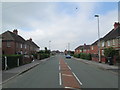
Haregate Road, Leek
Residential area north-east of the town centre. Looking south-west along Haregate Road towards Ball Haye Green, where there is terrace housing in the distance.
Image: © David Weston
Taken: 10 Jul 2013
0.11 miles
2
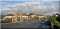
War Memorial and park at Ball Haye Green
Image: © Chris Morgan
Taken: 5 Dec 2012
0.12 miles
3
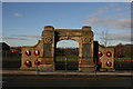
War memorial at Ball Haye Green
The Remembrance Day wreaths are still fresh on this memorial to those who died in the Great War.
Image: © Graham Hogg
Taken: 5 Dec 2012
0.15 miles
4
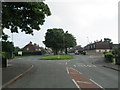
Haregate Road, Leek
North-east of the town centre. Looking north-east along Haregate Road.
Image: © David Weston
Taken: 10 Jul 2013
0.15 miles
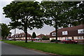
6
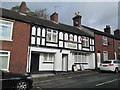
The Ball Haye Tavern, Leek
A pub in Ball Haye Green.
Image: © David Weston
Taken: 27 Oct 2019
0.18 miles
7
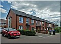
Modern houses at Ball Haye Green, Leek
Image: © Neil Theasby
Taken: 22 Jun 2021
0.18 miles
8
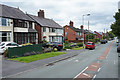
Windsor Road
A road with a mix of housing but mainly semi-detached houses.
Image: © Malcolm Neal
Taken: 2 Jul 2019
0.20 miles
9
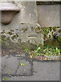
OS benchmark - Leek, Buxton Road
An OS cutmark at the base of a disused drinking fountain on the SE side of the Buxton Road; originally levelled at 218.721m above Ordnance Datum Newlyn.
Image: © Richard Law
Taken: 3 Jun 2014
0.24 miles