IMAGES TAKEN NEAR TO
Cranwood Road, STOKE-ON-TRENT, ST12 9JE
Introduction
This page details the photographs taken nearby to Cranwood Road, ST12 9JE by members of the Geograph project.
The Geograph project started in 2005 with the aim of publishing, organising and preserving representative images for every square kilometre of Great Britain, Ireland and the Isle of Man.

There are currently over 7.5m images from over14,400 individuals and you can help contribute to the project by visiting https://www.geograph.org.uk
Image Map
Images are licensed for reuse under creativecommons.org/licenses/by-sa/2.0
Notes
- Clicking on the map will re-center to the selected point.
- The higher the marker number, the further away the image location is from the centre of the postcode.
Image Listing (3 Images Found)
Images are licensed for reuse under creativecommons.org/licenses/by-sa/2.0
Image
Details
Distance
1
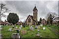
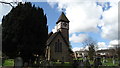
St. Luke's Church, Tittensor
The land was given by the Dowager Duchess of Sutherland in the mid 19th century and the foundation stone was laid by Duchess Millicent Leveson-Gower, Duchess of Sutherland https://en.wikipedia.org/wiki/Millicent_Leveson-Gower,_Duchess_of_Sutherland on the 18th June 1880. The Prince of Wales, who was later to become King Edward VII https://en.wikipedia.org/wiki/Edward_VII was Present.
It was consecrated by the Bishop of Lichfield https://en.wikipedia.org/wiki/George_Selwyn_(bishop_of_Lichfield) on the 27th December 1881.
Some of the stone work used to build the church came from the Tittensor family manor house that was demolished in 1834.
https://en.wikipedia.org/wiki/Tittensor
Image: © Brian Deegan
Taken: 23 Feb 2020
0.10 miles