
IMAGES TAKEN NEAR TO
Rookery Crescent, STOKE-ON-TRENT, ST11 9RA
Introduction
This page details the photographs taken nearby to Rookery Crescent, ST11 9RA by members of the Geograph project.
The Geograph project started in 2005 with the aim of publishing, organising and preserving representative images for every square kilometre of Great Britain, Ireland and the Isle of Man.

There are currently over 7.5m images from over14,400 individuals and you can help contribute to the project by visiting https://www.geograph.org.uk
Image Map
Images are licensed for reuse under creativecommons.org/licenses/by-sa/2.0
Notes
- Clicking on the map will re-center to the selected point.
- The higher the marker number, the further away the image location is from the centre of the postcode.
Image Listing (6 Images Found)
Images are licensed for reuse under creativecommons.org/licenses/by-sa/2.0
Image
Details
Distance
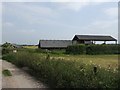
2
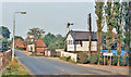
Level crossing over Stoke - Derby line at site of Cresswell station
View NE: North Stafford Railway Stoke (left) - Derby (right) main line, junction of branch to Cheadle. The station was on the right, but was closed from 7/11/66.
Image: © Ben Brooksbank
Taken: 27 Aug 1983
0.20 miles
3
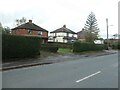
Houses on the west side of Sandon Road, Cresswell
According to the large-scale OS maps, built between 1923 and 1937.
Image: © Christine Johnstone
Taken: 2 Nov 2020
0.22 miles
4
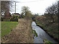
River Blithe downstream at Cresswell
The former GEC CREDA site lies to the left.
Image: © John M
Taken: 10 Apr 2010
0.24 miles
5
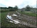
Muddy track, off Sandon Road, Cresswell
Used to reach the fields behind the houses.
Image: © Christine Johnstone
Taken: 2 Nov 2020
0.25 miles
6
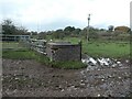
Manhole on a water pipeline
On the west side of Sandon Road, Cresswell. The OS mapped a filter bed here in 1937, but nothing in 1923.
Image: © Christine Johnstone
Taken: 2 Nov 2020
0.25 miles