
IMAGES TAKEN NEAR TO
Barlstone Avenue, STOKE-ON-TRENT, ST11 9PJ
Introduction
This page details the photographs taken nearby to Barlstone Avenue, ST11 9PJ by members of the Geograph project.
The Geograph project started in 2005 with the aim of publishing, organising and preserving representative images for every square kilometre of Great Britain, Ireland and the Isle of Man.

There are currently over 7.5m images from over14,400 individuals and you can help contribute to the project by visiting https://www.geograph.org.uk
Image Map
Images are licensed for reuse under creativecommons.org/licenses/by-sa/2.0
Notes
- Clicking on the map will re-center to the selected point.
- The higher the marker number, the further away the image location is from the centre of the postcode.
Image Listing (19 Images Found)
Images are licensed for reuse under creativecommons.org/licenses/by-sa/2.0
Image
Details
Distance
1
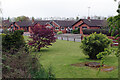
Blithe View, Blythe Bridge
This cul-de-sac of bungalows leads off Stallington Road just south of the River Blithe. Note the variation in the spelling of Blithe/Blythe.
Image: © Stephen McKay
Taken: 13 May 2021
0.05 miles
2
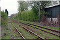
Railway east of Blythe Bridge
This is the line between Stoke-on-Trent and Derby, looking in the Derby direction from the Stallington Road level crossing. It looks as though it could do with the attentions of the weed killing train. The shed on the right belongs to a building supplies firm.
Image: © Stephen McKay
Taken: 13 May 2021
0.09 miles
3
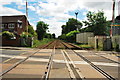
Railway Line on Stallington Road, Blythe Bridge
Image: © Stu JP
Taken: 21 Jun 2015
0.10 miles
4
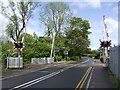
Level Crossing on Stallington Road
Level Crossing on Stallington Road in Blythe Bridge, taking the main line from the east into Stoke on Trent.
Image: © Ian Calderwood
Taken: 18 May 2007
0.10 miles
5
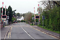
Stallington Road Level Crossing
The level crossing is on the Derby - Stoke-on-Trent railway line to the south east of Blythe Bridge station. The service, for most of the day, comprises two trains per hour so the crossing cannot be a major impedence to road traffic.
Image: © Stephen McKay
Taken: 13 May 2021
0.10 miles
6
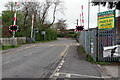
Stallington Road Level Crossing
Looking towards Blythe Bridge village, the opposite direction to Image On the right is the entrance to a building materials yard.
Image: © Stephen McKay
Taken: 13 May 2021
0.10 miles
7
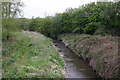
River Blithe, Blythe Bridge
The spelling of the river and the village of Blythe Bridge differ. Seen here from the Stallington Road bridge looking upstream, the Blithe is a tributary of the River Trent and rises near Heywood Grange in the hills to the north of Blythe Bridge.
Image: © Stephen McKay
Taken: 13 May 2021
0.10 miles
8
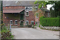
Blythe Bridge Mill
This old water mill on Stallington Road is the premises of E J Holdcroft & Sons, agricultural merchants.
Image: © Stephen McKay
Taken: 13 May 2021
0.14 miles
9
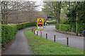
Stallington Road, Blythe Bridge
Stallington Road leads down from Uttoxeter Road to a level crossing and a bridge over the River Blithe (spelt differently from the village) before continuing to Stallington.
Image: © Stephen McKay
Taken: 13 May 2021
0.15 miles
10
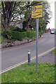
20 is plenty in Blythe Bridge
The sign tells motorists that they are entering a 'school safety zone' and that '20 is plenty'. The school in question is the William Amory Primary School (just out of shot to the right). The speed limit, although no doubt highly advisable when children are entering or leaving the school, is not legally enforceable on the basis of this sign.
Image: © Stephen McKay
Taken: 13 May 2021
0.16 miles