IMAGES TAKEN NEAR TO
Havensfield Drive, STOKE-ON-TRENT, ST10 4RR
Introduction
This page details the photographs taken nearby to Havensfield Drive, ST10 4RR by members of the Geograph project.
The Geograph project started in 2005 with the aim of publishing, organising and preserving representative images for every square kilometre of Great Britain, Ireland and the Isle of Man.

There are currently over 7.5m images from over14,400 individuals and you can help contribute to the project by visiting https://www.geograph.org.uk
Image Map (Loading...)


Getting Data...Please wait
Leaflet Map data © OpenStreetMap
Images are licensed for reuse under creativecommons.org/licenses/by-sa/2.0
Notes
- Clicking on the map will re-center to the selected point.
- The higher the marker number, the further away the image location is from the centre of the postcode.
Image Listing (3 Images Found)
Images are licensed for reuse under creativecommons.org/licenses/by-sa/2.0
Image
Details
Distance
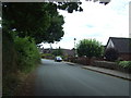
2

Traditional Caravans at Gorsty
These people had found a delightful spot for their traditional caravans on this pleasant, quiet road junction near to Gorsty. The closest photo category was 'caravan site' - which is sort of correct in that this is a site where there are caravans!
Image: © Mike Bardill
Taken: 7 Jun 2007
0.15 miles
3

Top of Gorsty Hill Road
Mobberley Quarry is just over the top of the hill.
A folding picnic chair is beside the junction, together with red pennant, presumably forgotten after a cycle or running event.
Image: © Chris Morgan
Taken: 21 Mar 2012
0.20 miles