
IMAGES TAKEN NEAR TO
Toothill Lane, STOKE-ON-TRENT, ST10 4BP
Introduction
This page details the photographs taken nearby to Toothill Lane, ST10 4BP by members of the Geograph project.
The Geograph project started in 2005 with the aim of publishing, organising and preserving representative images for every square kilometre of Great Britain, Ireland and the Isle of Man.

There are currently over 7.5m images from over14,400 individuals and you can help contribute to the project by visiting https://www.geograph.org.uk
Image Map
Images are licensed for reuse under creativecommons.org/licenses/by-sa/2.0
Notes
- Clicking on the map will re-center to the selected point.
- The higher the marker number, the further away the image location is from the centre of the postcode.
Image Listing (37 Images Found)
Images are licensed for reuse under creativecommons.org/licenses/by-sa/2.0
Image
Details
Distance
1

Red Road meeting Horse Road on the outskirts of Alton
Image: © Mick Malpass
Taken: 14 Apr 2012
0.10 miles
2
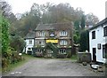
The Talbot, Alton
Named after the family who owned Alton Towers (and probably most of Alton village). It is also the name of and extinct breed of hound, and of a famous make of motor car.
Image: © Humphrey Bolton
Taken: 11 Nov 2009
0.11 miles

4
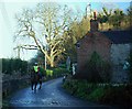
Ford and Rider at Alton
This minor cobbled ford is found at the junction of Station Road, Red Road and Horse Road. The photograph is taken looking towards Alton Castle.
Image: © John Walton
Taken: 28 Dec 2013
0.12 miles
5
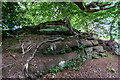
Interesting Tree Roots, Staffs Way, Alton
Interesting tree roots on the Staffordshire Way
Image: © Brian Deegan
Taken: 13 Jun 2020
0.15 miles
6
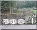
Path to Alton Station
A triple path with three double gates. A reminder that this was a busy station when twelve-coach trains brought trippers to Alton Towers.
Image: © Humphrey Bolton
Taken: 11 Nov 2009
0.16 miles
7
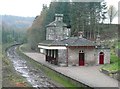
Alton Station
This former railway station was built c.1849, when the line from The Potteries to Uttoxeter opened. See http://en.wikipedia.org/wiki/North_Staffordshire_Railway and http://en.wikipedia.org/wiki/Alton_railway_station,_Staffordshire (which includes Geograph image 175558).
Image: © Humphrey Bolton
Taken: 11 Nov 2009
0.16 miles
8
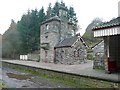
Alton Station
This former railway station was built c.1849. It is in Italianate style and was probably designed by H A Hunt, who designed other stations on this line. It was conveyed by the County Council to the Landmark Trust in 1970, and is now a holiday cottage for up to eight people; sleeping quarters in the Station Master's house, cooking and dining facilities in the former waiting room. (Information from The Landmark Trust Handbook, 2011)
Image: © Humphrey Bolton
Taken: 11 Nov 2009
0.16 miles
9
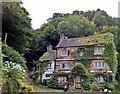
The Talbot Inn, Alton
Sadly closed on this day.
Image: © Chris Morgan
Taken: 17 Aug 2015
0.16 miles
10

Deep in the Churnet Valley
Narcissi on the bank of the Churnet near the head of Dimmingsdale
Image: © Dominic Robinson
Taken: 28 Apr 2003
0.17 miles