
IMAGES TAKEN NEAR TO
Rue Hill, STOKE-ON-TRENT, ST10 3HA
Introduction
This page details the photographs taken nearby to Rue Hill, ST10 3HA by members of the Geograph project.
The Geograph project started in 2005 with the aim of publishing, organising and preserving representative images for every square kilometre of Great Britain, Ireland and the Isle of Man.

There are currently over 7.5m images from over14,400 individuals and you can help contribute to the project by visiting https://www.geograph.org.uk
Image Map
Images are licensed for reuse under creativecommons.org/licenses/by-sa/2.0
Notes
- Clicking on the map will re-center to the selected point.
- The higher the marker number, the further away the image location is from the centre of the postcode.
Image Listing (7 Images Found)
Images are licensed for reuse under creativecommons.org/licenses/by-sa/2.0
Image
Details
Distance
1
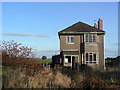
Des Res
This house may well have been built by one of the local quarry owners for an employee. Quarry and house are both abandoned.
Image: © Alan Murray-Rust
Taken: 16 Nov 2008
0.02 miles
2
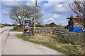
Telephone box on the road to Wardlow Quarry
Looking in the direction of the A52 with Red House to the right.
Image: © Nikki Mahadevan
Taken: 13 Mar 2007
0.04 miles
3
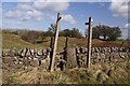
Footpath north of the A52
This footpath leads off north from the A52 towards the massive Caldonlow Quarries. In the other direction, the footpath crosses the A52 to follow a lane down to Wardlow Quarry.
Image: © Nikki Mahadevan
Taken: 13 Mar 2007
0.10 miles
4
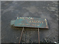
Wredon Quarry
Although the OS maps show what appears to be a single quarry at Wardlow, in fact the northern part of the site was a separate operation, and aerial views show that boundary between the workings. Both are now no longer worked although part of the Wredon Quarry site houses a small transport business.
Image: © Alan Murray-Rust
Taken: 16 Nov 2008
0.12 miles
5
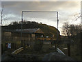
Wredon Quarry
This is the old exit from the quarry, with a spray area to remove the worst of the dust from lorries leaving the site.
Image: © Alan Murray-Rust
Taken: 16 Nov 2008
0.14 miles
7
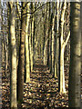
Footpath through the trees
This is a relatively recent realignment of a footpath which has been affected by expansion of the neighbouring Cauldon Quarry. The deliberate planting in this linear windbreak is very evident.
Image: © Alan Murray-Rust
Taken: 16 Nov 2008
0.22 miles