
IMAGES TAKEN NEAR TO
Park Lane, STOKE-ON-TRENT, ST10 2NE
Introduction
This page details the photographs taken nearby to Park Lane, ST10 2NE by members of the Geograph project.
The Geograph project started in 2005 with the aim of publishing, organising and preserving representative images for every square kilometre of Great Britain, Ireland and the Isle of Man.

There are currently over 7.5m images from over14,400 individuals and you can help contribute to the project by visiting https://www.geograph.org.uk
Image Map
Images are licensed for reuse under creativecommons.org/licenses/by-sa/2.0
Notes
- Clicking on the map will re-center to the selected point.
- The higher the marker number, the further away the image location is from the centre of the postcode.
Image Listing (9 Images Found)
Images are licensed for reuse under creativecommons.org/licenses/by-sa/2.0
Image
Details
Distance
1
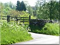
Entrance to Ipstones Park Farm
The western of the two mapped farms with this name on Park Lane.
Image: © Christine Johnstone
Taken: 27 May 2012
0.08 miles
2

Park Lane
Staffordshire Moorlands, not London's Hyde Park.
Image: © Christine Johnstone
Taken: 27 May 2012
0.08 miles
3
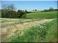
Corner of a recently mown hayfield
On the south side of Park Lane.
Image: © Christine Johnstone
Taken: 27 May 2012
0.10 miles
4

Hayfield above wooded valley
On the south side of Park Lane.
Image: © Christine Johnstone
Taken: 27 May 2012
0.11 miles
5
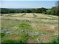
Recently mown hayfield
South of Park Lane. This is the field that can be seen in the distance in Image
Image: © Christine Johnstone
Taken: 27 May 2012
0.12 miles
6

Trees and farmland, Ipstones Park
On the north side of Park Lane.
Image: © Christine Johnstone
Taken: 27 May 2012
0.12 miles
7
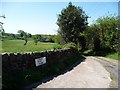
Track to Lower Park Farm
Also part of the Staffordshire Moorland Walks.
Image: © Christine Johnstone
Taken: 27 May 2012
0.15 miles
8
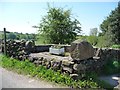
Redundant street furniture, Park Lane, Ipstones Park
The footpath that the old sign points to seems to have been moved to the track to Lower Park Farm. What looks like an old milk churn stand has been re-used as a base for an old sink full of flowers.
Image: © Christine Johnstone
Taken: 27 May 2012
0.15 miles
9

Hopestone
"This natural rock outcrop, vaguely resembling the head of a man, may be the 'upper stone' or 'yppe' which is referred to in the origin of the name Ipstones". (Tim Cockin: The Staffordshire Encyclopaedia)
This view was first published in 1988 on p.157 of "Staffordshire and the Black Country" by Michael Raven, who described it as "a most picturesque sight".
Image: © Ian Calderwood
Taken: 29 Apr 2007
0.17 miles