IMAGES TAKEN NEAR TO
Woodside, LEIGH-ON-SEA, SS9 4TB
Introduction
This page details the photographs taken nearby to Woodside, SS9 4TB by members of the Geograph project.
The Geograph project started in 2005 with the aim of publishing, organising and preserving representative images for every square kilometre of Great Britain, Ireland and the Isle of Man.

There are currently over 7.5m images from over14,400 individuals and you can help contribute to the project by visiting https://www.geograph.org.uk
Image Map
Images are licensed for reuse under creativecommons.org/licenses/by-sa/2.0
Notes
- Clicking on the map will re-center to the selected point.
- The higher the marker number, the further away the image location is from the centre of the postcode.
Image Listing (4 Images Found)
Images are licensed for reuse under creativecommons.org/licenses/by-sa/2.0
Image
Details
Distance
1
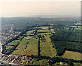
Aerial view of Garrolds Farm and part of Pound Wood
Garrolds Farm occupies much of the centre of this photo. The farm buildings are just left of centre. The wood to the right is Pound Wood Nature Reserve http://www.poundwood.org.uk/ , owned and managed by the Essex Wildlife Trust http://www.essexwt.org.uk/. Image shows a closer view of the corner of the wood.
The woodland in the middle distance is Belfairs Nature Reserve. The road across the bottom left corner is the A127 (London to Southend Arterial Road). The minor road just visible and running across the bottom is the Eastwood Old Road.
Image: © Edward Clack
Taken: 3 Aug 1987
0.20 miles
2
The A127, Eastwood
The pampas grass and flowers along the central reservation makes a great difference to the appearance of the road.
Image: © David Howard
Taken: 8 Apr 2019
0.21 miles
3
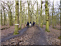
Horse riding in Belfairs Great Wood
The white rings on the trees appear to mark the official bridleway.
Image: © Robin Webster
Taken: 28 Feb 2016
0.25 miles