IMAGES TAKEN NEAR TO
Mountdale Gardens, LEIGH-ON-SEA, SS9 4AJ
Introduction
This page details the photographs taken nearby to Mountdale Gardens, SS9 4AJ by members of the Geograph project.
The Geograph project started in 2005 with the aim of publishing, organising and preserving representative images for every square kilometre of Great Britain, Ireland and the Isle of Man.

There are currently over 7.5m images from over14,400 individuals and you can help contribute to the project by visiting https://www.geograph.org.uk
Image Map
Images are licensed for reuse under creativecommons.org/licenses/by-sa/2.0
Notes
- Clicking on the map will re-center to the selected point.
- The higher the marker number, the further away the image location is from the centre of the postcode.
Image Listing (9 Images Found)
Images are licensed for reuse under creativecommons.org/licenses/by-sa/2.0
Image
Details
Distance
2
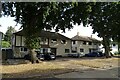
Housing on Hurst Way
One complete with stone cladding and mock Tudor half timbering.
Image: © John Allan
Taken: 15 Apr 2013
0.14 miles
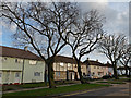
4
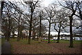
Trees beside Eastwood Road North
An old stand of trees between Eastwood Road North and Stonehill Road just south of the A127 Arterial Road.
Image: © Trevor Harris
Taken: 3 Jan 2019
0.22 miles
5
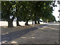
Old Oak field boundary and bank in Blenheim Park
Image: © Samantha Whitaker
Taken: 11 Aug 2006
0.23 miles
6
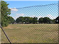
Old field boundary Blenheim School
Image: © Samantha Whitaker
Taken: 11 Aug 2006
0.23 miles
7
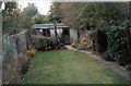
135 Bleinham Cr. Leigh-on-Sea
The back garden
Image: © D Williams
Taken: 22 Oct 1996
0.23 miles
8
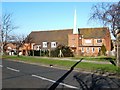
St Cedds Westcliff-on-Sea
St Cedds is a modern building in Bridgewater Drive.
Image: © Glyn Baker
Taken: 10 Feb 2006
0.23 miles