
IMAGES TAKEN NEAR TO
Fairleigh Mews, Fairleigh Drive, LEIGH-ON-SEA, SS9 2HF
Introduction
This page details the photographs taken nearby to Fairleigh Mews, Fairleigh Drive, SS9 2HF by members of the Geograph project.
The Geograph project started in 2005 with the aim of publishing, organising and preserving representative images for every square kilometre of Great Britain, Ireland and the Isle of Man.

There are currently over 7.5m images from over14,400 individuals and you can help contribute to the project by visiting https://www.geograph.org.uk
Image Map
Images are licensed for reuse under creativecommons.org/licenses/by-sa/2.0
Notes
- Clicking on the map will re-center to the selected point.
- The higher the marker number, the further away the image location is from the centre of the postcode.
Image Listing (36 Images Found)
Images are licensed for reuse under creativecommons.org/licenses/by-sa/2.0
Image
Details
Distance
1
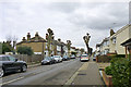
Southsea Avenue, Leigh
One of a great many similar and parallel residential roads forming a large grid from Leigh through to Westcliff and beyond.
Image: © Robin Webster
Taken: 28 Feb 2016
0.09 miles
2
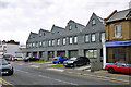
New build on Glendale Gardens, Leigh
Formerly a commercial yard.
Image: © Robin Webster
Taken: 28 Feb 2016
0.12 miles
3
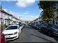
Leighville Grove, Southend-on-Sea
Looking north.
Image: © JThomas
Taken: 23 Aug 2022
0.12 miles
4
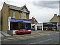
Corner businesses, Leigh
At the Glendale Gardens - Lymington Avenue junction.
Image: © Robin Webster
Taken: 28 Feb 2016
0.13 miles
5
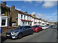
Houses on Leighville Grove, Southend-on-Sea
Image: © JThomas
Taken: 23 Aug 2022
0.14 miles
6
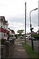
Westleigh Ave
Westleigh Ave is typical of the "between the wars" development that happened around Southend.
Image: © Glyn Baker
Taken: 20 May 2016
0.14 miles
7

View of St Clement's Court, Broadway West from the High Street
Looking north-northeast.
Image: © Robert Lamb
Taken: 25 Oct 2014
0.16 miles
8
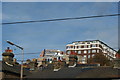
View of Eden Point and St Clement's Court on Rectory Grove and Broadway West from the High Street
Looking north. Eden Point (on the left) looks to have only been completed this year, as the Streetview from June 2014 shows it still in plastic sheeting: https://www.google.co.uk/maps/@51.5426901,0.6505821,3a,75y,157.83h,108.24t/data=!3m4!1e1!3m2!1sMgo9RZ5d2vWsgnssylg2dA!2e0.
Image: © Robert Lamb
Taken: 25 Oct 2014
0.16 miles
9
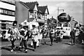
The Southend Carnival processing along Rectory Grove in 1963
The year is correct but the day & month are approximate.
Image: © Antony Ewart Smith
Taken: 21 Jul 1963
0.17 miles
10
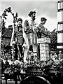
The Southend Carnival processing along Rectory Grove in 1963
The year is correct but the day & month are approximate.
Image: © Antony Ewart Smith
Taken: 21 Jul 1963
0.17 miles