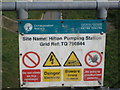
IMAGES TAKEN NEAR TO
Jarvis Road, CANVEY ISLAND, SS8 9FJ
Introduction
This page details the photographs taken nearby to Jarvis Road, SS8 9FJ by members of the Geograph project.
The Geograph project started in 2005 with the aim of publishing, organising and preserving representative images for every square kilometre of Great Britain, Ireland and the Isle of Man.

There are currently over 7.5m images from over14,400 individuals and you can help contribute to the project by visiting https://www.geograph.org.uk
Image Map
Images are licensed for reuse under creativecommons.org/licenses/by-sa/2.0
Notes
- Clicking on the map will re-center to the selected point.
- The higher the marker number, the further away the image location is from the centre of the postcode.
Image Listing (6 Images Found)
Images are licensed for reuse under creativecommons.org/licenses/by-sa/2.0
Image
Details
Distance
1
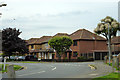
Houses on Papenburg Road, Canvey Island
Image: © Robin Webster
Taken: 28 May 2017
0.10 miles
2
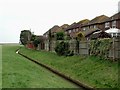
Last Ditch Defence
These houses in Hardy’s Way Canvey Island have magnificent rear views across the golf course towards Benfleet. However it remains to be seen if the small concrete channel will be enough to protect them if global warming causes rising sea level.
Image: © Glyn Baker
Taken: 15 Jan 2006
0.17 miles
3
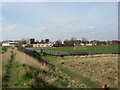
Castle View School
Seen from the golf course.
Image: © Ron Galliers
Taken: 17 Mar 2009
0.19 miles
4
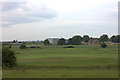
Castle Point golf club and Canvey Skills Campus
Image: © Robert Eva
Taken: 2 Jun 2017
0.21 miles
5
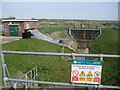
Hilton Road pumping station
On the north side of Somnes Avenue.
Image: © Ron Galliers
Taken: 17 Mar 2009
0.23 miles