
IMAGES TAKEN NEAR TO
Dovercliff Road, CANVEY ISLAND, SS8 7PF
Introduction
This page details the photographs taken nearby to Dovercliff Road, SS8 7PF by members of the Geograph project.
The Geograph project started in 2005 with the aim of publishing, organising and preserving representative images for every square kilometre of Great Britain, Ireland and the Isle of Man.

There are currently over 7.5m images from over14,400 individuals and you can help contribute to the project by visiting https://www.geograph.org.uk
Image Map
Images are licensed for reuse under creativecommons.org/licenses/by-sa/2.0
Notes
- Clicking on the map will re-center to the selected point.
- The higher the marker number, the further away the image location is from the centre of the postcode.
Image Listing (37 Images Found)
Images are licensed for reuse under creativecommons.org/licenses/by-sa/2.0
Image
Details
Distance
1
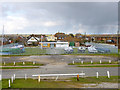
Chapman Sands Sailing Club
A small club and the only one on the exposed south side of Canvey Island.
Image: © Robin Webster
Taken: 21 Feb 2015
0.03 miles
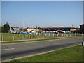
3
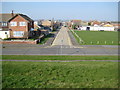
Canvey Island: Station Road
The road name is intriguing. Canvey Island does not have a railway, yet alone a railway station, nor is there any evidence that it ever did have one. Perhaps the station referred to is a drainage pumping station or maybe a railway was intended to be built, and the road was named in anticipation.
This is the view from the sea defence wall.
Image: © Nigel Cox
Taken: 8 Mar 2011
0.06 miles
4
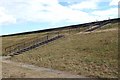
Steps in Leigh Beck
This stairway gives an impression of the enormity of the task of preventing the River Thames from washing Canvey Island off the face of the earth.
Image: © Glyn Baker
Taken: 9 Oct 2016
0.06 miles
5
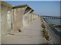
Canvey Island: Sea defence wall shelter
Shelters along Canvey's sea defence wall are sparse and to say the least rudimentary... This one does not even have a seat.
Image is visible in the distance.
Image: © Nigel Cox
Taken: 8 Mar 2011
0.07 miles
6
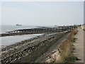
Sailing club slipway
Slipway for the Chapman Sands sailing club, just over the sea wall to the right.
Image: © Ron Galliers
Taken: 17 Mar 2009
0.08 miles
7
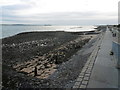
The seafront at Canvey Island
Canvey Island lies only just above sea level and was, of course, devastated in the flood of 1st February 1953 when 58 inhabitants drowned. After the flood a new sea wall was constructed which was replaced by a much larger structure in the 1980s. This view is from the top of the sea wall at the eastern end of Eastern Esplanade.
The land on the left horizon is the Hundred of Hoo in Kent, across the Thames Estuary.
Image: © Marathon
Taken: 21 Aug 2016
0.09 miles
8

Canvey Island: Chapman Sands Sailing Club Slipway
Chapman Sands is a large submerged sand bank about a kilometre to the east of Canvey Island. At high tide two large ships exit the River Thames and head for the North Sea.
Image: © Nigel Cox
Taken: 8 Mar 2011
0.10 miles
9
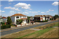
Eastern Esplanade, Canvey Island
The road leading left is Marine Avenue. Taken looking down from the seawall.
Image: © David Kemp
Taken: 28 Jul 2018
0.10 miles
10
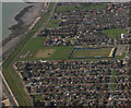
Aerial view over Canvey Island
Park Lane the home ground of Canvey Island Football Club can be seen in this photo.
Image: © terry joyce
Taken: 6 Mar 2009
0.11 miles