
IMAGES TAKEN NEAR TO
Northwick Road, CANVEY ISLAND, SS8 0SW
Introduction
This page details the photographs taken nearby to Northwick Road, SS8 0SW by members of the Geograph project.
The Geograph project started in 2005 with the aim of publishing, organising and preserving representative images for every square kilometre of Great Britain, Ireland and the Isle of Man.

There are currently over 7.5m images from over14,400 individuals and you can help contribute to the project by visiting https://www.geograph.org.uk
Image Map
Images are licensed for reuse under creativecommons.org/licenses/by-sa/2.0
Notes
- Clicking on the map will re-center to the selected point.
- The higher the marker number, the further away the image location is from the centre of the postcode.
Image Listing (14 Images Found)
Images are licensed for reuse under creativecommons.org/licenses/by-sa/2.0
Image
Details
Distance
3
They get everywhere
Canvey's drive-through.
Image: © Ron Galliers
Taken: 20 Mar 2009
0.08 miles


6
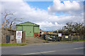
Barn on Northwick Road
One of a few premises, mainly to do with horses, on the edge of the undeveloped north-west corner of Canvey Island.
Image: © Robin Webster
Taken: 21 Feb 2015
0.14 miles
7
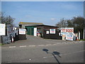
An old-style takeaway
Run by 'Mr Canvey' (a local Councillor) you can get genuine free-range eggs, potatoes, fish and even straw for your horse.
Image: © Ron Galliers
Taken: 20 Mar 2009
0.15 miles
8
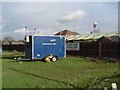
Canvey Island Air Monitoring Station
The trailer is an air monitoring station. It is located near to the junction of Northwick Road and Canvey Rd Canvey Island. The Garden World Garden Centre is in the background.
Image: © Glyn Baker
Taken: 31 Dec 2005
0.15 miles

10
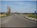
The way to London
The southern end of Roscommon Way heading for the A130 and Sadler's Farm.
Image: © Ron Galliers
Taken: 20 Mar 2009
0.17 miles