IMAGES TAKEN NEAR TO
Thorp Leas, CANVEY ISLAND, SS8 0BA
Introduction
This page details the photographs taken nearby to Thorp Leas, SS8 0BA by members of the Geograph project.
The Geograph project started in 2005 with the aim of publishing, organising and preserving representative images for every square kilometre of Great Britain, Ireland and the Isle of Man.

There are currently over 7.5m images from over14,400 individuals and you can help contribute to the project by visiting https://www.geograph.org.uk
Image Map
Images are licensed for reuse under creativecommons.org/licenses/by-sa/2.0
Notes
- Clicking on the map will re-center to the selected point.
- The higher the marker number, the further away the image location is from the centre of the postcode.
Image Listing (20 Images Found)
Images are licensed for reuse under creativecommons.org/licenses/by-sa/2.0
Image
Details
Distance
1
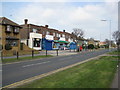
Supermarket Furtherwick Road
At the bottom (southern) end of Furtherwick Road near Labworth Green.
Image: © Ron Galliers
Taken: 22 Mar 2009
0.13 miles
2
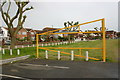
Western Esplanade, Canvey Island
Taken from the car park at Thorney Bay.
Image: © David Kemp
Taken: 12 May 2018
0.16 miles
3
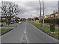
Furtherwick Road
Looking north towards Long Road.
Image: © Ron Galliers
Taken: 13 Feb 2005
0.18 miles
4
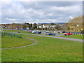
Car Park, Thorney Bay, Canvey Island
Prior to the 1953 floods and subsequent sea defence improvement, the green area to the left of the long path was on the sea side of the sea wall and was saltings. The path follows the line of the old sea wall.
Image: © Robin Webster
Taken: 21 Feb 2015
0.18 miles
5
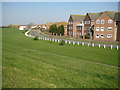
Canvey Island: Western Esplanade
The Western Esplanade first appeared as a road on an Ordnance Survey map of the island on the Edition of 1939, but the housing development on the right only came much later, after 1980 at least. This is the view looking along the east side of Thorney Bay.
Image: © Nigel Cox
Taken: 8 Mar 2011
0.20 miles
6
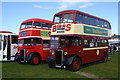
Vintage buses at Labworth Park, Canvey
The bus on the left is a former Northampton Corporation Crossley with Roe bodywork dating from 1946. Next to it is an all-Crossley vehicle once owned by Sunderland Corporation and a year younger than its neighbour. Both vehicles (and many others) were at a bus rally sponsored by the nearby Castle Point Transport Museum on the occasion of its annual open day.
Image: © David Kemp
Taken: 9 Oct 2016
0.20 miles
7
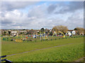
Play area, Thorney Bay, Canvey Island
Prior to the 1953 floods and subsequent sea defence improvement, this green area was on the sea side of the sea wall and was saltings. The mapped public footpath follows the line of the old sea wall.
Image: © Robin Webster
Taken: 21 Feb 2015
0.20 miles
8
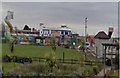
Canvey on a Dull Day
Canvey Town Park on a dull wet day.
Sorry for the bad condition!
Image: © Lucas William
Taken: 1 Feb 2007
0.20 miles
9
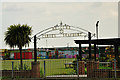
The approach to the seafront at Canvey Island
Image: © Brian Chadwick
Taken: 14 May 2010
0.21 miles