
IMAGES TAKEN NEAR TO
SS7 9FW
Introduction
This page details the photographs taken nearby to SS7 9FW by members of the Geograph project.
The Geograph project started in 2005 with the aim of publishing, organising and preserving representative images for every square kilometre of Great Britain, Ireland and the Isle of Man.

There are currently over 7.5m images from over14,400 individuals and you can help contribute to the project by visiting https://www.geograph.org.uk
Image Map
Images are licensed for reuse under creativecommons.org/licenses/by-sa/2.0
Notes
- Clicking on the map will re-center to the selected point.
- The higher the marker number, the further away the image location is from the centre of the postcode.
Image Listing (22 Images Found)
Images are licensed for reuse under creativecommons.org/licenses/by-sa/2.0
Image
Details
Distance
1
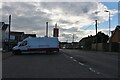
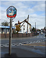
Parking area on Church Road, Thundersley
The post office is on the left.
Image: © David Howard
Taken: 25 May 2021
0.02 miles
2
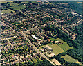
Aerial view of Kingston School and southern Thundersley
This view is almost of the same area as Image, but from the opposite direction. Kingston Primary School lies lower-centre, with the Church Road to its left. The white-roofed building just below-left of centre is the postal sorting office. The wood to the right is Coombe Wood. For other roads and buildings see Image
Image: © Edward Clack
Taken: 1 Jul 1987
0.02 miles
4
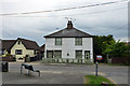
Cottages, Hart Road, Thundersley
One of the few older buildings in this area. Grade II listed, 18th/19th century.
Image: © Robin Webster
Taken: 28 May 2017
0.07 miles
5
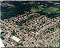
Aerial view of the Church Road - Hart Road junction, Thundersley
Church Road runs from centre-left to the lower centre. From the mini-roundabout, it continues as Hart Road to the lower right. The other road leading from the mini-roundabout to the bottom is Kenneth Road. The roads from the Church/Hart Road leading upper right are (from the left) Grasmere road, Borrowdale Road (with Borrowdale Close leading from it) and Raymonds Drive. The long white-roofed building in the lower right is the postal sorting office. The building to the right of this, at the Kenneth Road - Church Road junction is a clinic. The white triangle at the lower left is the aircraft wing.
Image: © Edward Clack
Taken: 1 Jul 1987
0.11 miles
7
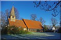
St Peters Thundersley
St Peters was built in the 12th Century, but the extension dates from 1966. From the outside this looks quite pleasing in that the extension does not pretend to be anything else but of its time, however it does blend well with the ancient structure. Learn more at http://www.thundersley.org/stpeters.html
Image: © Glyn Baker
Taken: 1 Jan 2010
0.20 miles
8
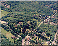
Aerial view of St Peters Church and Coombe Wood, Thundersley
St Peter's Church lies below-left of centre. The church spire is obscured by the trees. The road skirting the lower left is the Church Road. The road extending off this towards the upper right is Rhoda Road North. Much of this is unmade. The wood occupying the upper part is Coombe Wood. The lower right of the image shows the escarpment, seen from the other direction in Image
Image: © Edward Clack
Taken: 6 Jun 1987
0.20 miles
9

St Peter, Thundersley - east elevation
The east end of the church seen here is part of an extension added in 1965-66 and stands in stark contrast to the more picturesque, medieval west end. But seen from the south the church looks considerably more attractive than it does here.
Image: © David Kemp
Taken: 24 Apr 2026
0.20 miles
10

St Peter, Thundersley - south-east elevation
The large extension of 1965-66 dwarfs the rest of the medieval part of the church but repeats the latter's steep roof albeit on a larger scale.
Image: © David Kemp
Taken: 24 Apr 2026
0.21 miles